
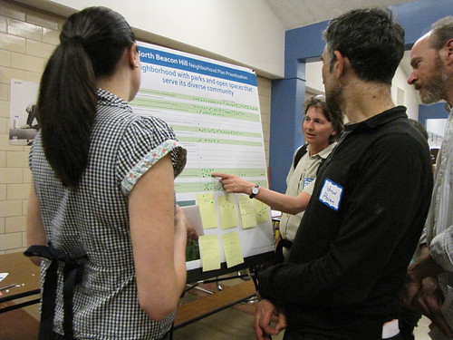
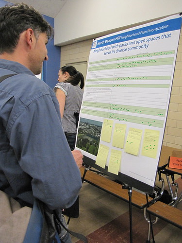
One concern expressed by several people was that the ideas on the boards seemed to be poorly chosen, including some projects that were already built or being built. (For example, one of the ideas was to put lids on the reservoirs at Jefferson Park, a project which has already happened.) Many people were choosing to use their stickers to prioritize projects that have already been done, instead of prioritizing new potential ideas for the Hill.
Other ideas on the boards were vague, such as “Supporting a safe and healthy community,” which received a large number of support stickers from neighbors at the event. However, many other concepts on the boards were more specific, such as “SDOT Street Use will review and approve permits for benches and banners.”
If you could not make it to the meeting last night, you can participate online by filling out an online survey.


Thanks for the update for those of us who couldn’t attend. I just took the survey online and didn’t see any problems like asking about projects already completed on it.
Here is my take on the transportation strategies:
SETS North Beacon Urban Village Projects #1-7
Why is DPD only asking people about 2008 South East Transportation Study (SETS) strategies #4 and #6 when there are seven strategies in the urban village section of the SETS? There are also other SETS strategies in our planning area in #46-51.
Projects #1 and 2 Beacon and 14th, 15th avenue from Beacon to Stevens: These are very important to people who want to safely get to Beacon Hill Elementary school through the intersection of Beacon Avenue and 14th, residents of Westview Apartments (many minority families) trying to get across Beacon Avenue, and for people who want to safely cross 15th Avenue between Beacon and Stevens. Safe east-west pedestrian access all along the 14th and 15th corridor is terrible!
Project #3 For Beacon Avenue and Lander: There are new recommendations that have been made but not included in the strategies: The Beacon Town Center concept calls for Lander Festival street to be extended west of Beacon. There are other details that are not described. DPD should include the map that was created and this information should be provided to SDOT in detail. I also hear a lot of neighbors complaining about the current crossing at Beacon and Lander to the light rail station. It is extremely dangerous and Sound Transit needs to finish their work there and not leave SDOT on the hook.
Project #4 Beacon and McClellan sidewalk at island: What will happen to the beautiful cherry tree in the island if this sidewalk is put in? This is the only tree in this part of the town center and it has gorgeous flowers. Community members have opposed the loss of this tree in the past. If this link is put in it should be integrated with the Town Center concept and additional right-of-way should be dedicated to the sidewalk instead of taking the sidewalk out of the green space and removing the tree.
Project #7 Beacon Avenue along it’s full length: Needs to be updated using more detailed discussions with community in light of other neighborhood initiatives, including the Beacon Family Bike and Pedestrian Plan and the Beacon Town Center proposal for rerouting traffic on Beacon from McClellan to 15th. What happened to the Beacon Boulevard recommendation to connect the light rail station to Jefferson Park with green improvements? That has been mentioned over and over!
SETS Beacon Hill Projects #46-51
These projects are also in and around our planning area (especially the ones at Jefferson Park) and people have made comments relevant to these that are not in DPD goals, policies or strategies.
#46 Spokane Street between Columbian Way and 23rd. This is the northern boundary of our amazing new Jefferson Park and it is in our planning area. People want pedestrian access and bike access to the park. We are asking for a pedestrian and bike crossing at Lafayette in conjunction with a family bike boulevard on Lafayette. This is where the surface paths in the park come down to the street. Spokane needs to be put on a road diet, with one lane each way, bike lanes, and a significant pedestrian facility at Lafayette.
#47 15th and Oregon: This project is consistent with neighbors desires for improved pedestrian access and improved school access for bikes. This has not been included in your strategies. Why donÂ’t neighbors near this growing retail center and school families at Mercer Middle school get to have their recommendations for this busy area in our neighborhood plan?
#48-51 These projects overlap with recommendations for the Beacon Family Bike and Pedestrian Plan, designed to get our children to our local schools.
The SETS is not a substitute for neighborhood plan recommendations. Neither is the Bike Master Plan. SETS is dated at this point. It does not take into account the opening of Jefferson Park and transportation issues around getting into the park from 15th and Spokane. The Bike Plan is very weak for SE as they prioritized neighborhoods with higher current bike activity and commuters (north end).
There is nothing in the Bike Master Plan for children, families, and ordinary people who want to use a bike to ride safely to local schools and destinations. That is why we need
the finer-grained, more innovative design of the Beacon Family Bike and Pedestrian Circulation Plan being developed by the community in cooperation with SDOT.
Transit: There are no recommendations for creating better connections to the light rail station from existing multi-family housing. The major hubs are: north end of the hill in L1, L2 areas. At the Columbian Way Exit and Spokane. The Columbian Way multi-housing area is very poorly served for bike and ped access to the town center and Jefferson Park and transit connections to the light rail station. Why does DPD only want to build new housing and not help people (many of whom are poor and minority) in existing multi-family housing?
All along 15th Avenue S. we need improved access to Jefferson Park from the west side. We need a pedestrian crossing at Columbian and 15th at the existing light. Families and children run across here to catch the bus. They will do this even more when the park opens. It is very unsafe! It is unreasonable to expect them to walk to Dakota. It won’t happen and they shouldn’t have to. That signal needs to be useful to all people, not just cars.
Hope that helps!
FM