Jungle and greenbelt plans to be discussed 10/21

The Jungle and the East Duwamish greenbelt have a notable (one might say infamous) impact on public safety in the west Beacon Hill area. Interested in the future of this area? Plan to attend a meeting this coming Tuesday to discuss creating a permanent public safety solution for the area. The meeting is October 21, 7:00 pm, at Quarters 1, PacMed Campus, on the northwest corner of 14th Avenue South and South Judkins Street .

Those attending will include Washington State Representative Sharon Tomiko-Santos, Lorena Eng of the Washington State Department of Transportation, and representatives from the City of Seattle Department of Transportation, Department of Neighborhoods, and the Mayor’s office, as well as directors from the Mountains to Sound Greenway Trust and others.

Thanks to Craig Thompson for the info!

Debate watching at Grown Folks

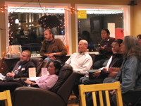
People intently watching the presidential debate at Grown Folks Coffee House, 10/15. Photo by Jason.
A few days ago we posted about the debate viewing party at Grown Folks. We were there tonight for the debate, and it was fun, though I’d say the crowd was a bit more subdued than I expected. (There was some heckling, booing, and cheering, though!) This was our first visit to Grown Folks, and we had some very tasty sandwiches. They will be hosting election returns viewing all day on Election Day, so maybe we’ll be back.

“Beacon Hill est omnis divisa in partes tres…”

On the Beacon Hill mailing list today, Mike Cheney asked the question:

“Why has the hill been broken up into 3 sections? You have north beacon, mid beacon and south beacon. Seems like creating divisions in one huge neighborhood could lead to prejudice and a further division of neighbors. Aka my neighborhood is better than yours kind of thing then you end up with even a bigger problem.”

This is an interesting question. Why is Beacon Hill divided into three parts on the city’s neighborhood map, informal as it may be? Unlike Mike, though, I wonder why it’s not divided even more. The Hill is huge. Look at a Seattle map. Beacon Hill is too big to be one neighborhood–it’s really a meta-neighborhood, a large area containing several smaller neighborhoods. North Beacon has its own personality that differs from South Beacon and Mid Beacon. Each area has concerns that the others do not have. For example, North Beacon has sidewalks almost everywhere. South Beacon… not so much. So it makes sense that South Beacon would have sidewalks as a priority, while people in North Beacon would prioritize other things.

A successful, sustainable neighborhood is, ideally, defined by a five-minute or 1/4 mile walking distance from center to edge, and being relatively self-contained and walkable. It would contain about 5,000 residents, and local schools and businesses to serve them. Basically, it’s an area that is small enough that people can easily access local services within the neighborhood, while being large enough to support those services. (It sounds a little small by sprawling modern Seattle standards, but small neighborhood units like this used to be in place here. Look at any old Seattle neighborhood that was built-up before the 1930s, particularly along one of the old streetcar routes, and see how every half mile or so there is a small clump of old commercial buildings, now mostly used as residences. The rise of the car and modern zoning practices have killed a lot of the old neighborhood business districts.) Incidentally, this is approximately the same size as a census tract.

Look at a map: a walk down Beacon Avenue from north to south is more than five miles. To get some perspective–as the crow flies, five miles north of the North Beacon business district “junction” is the University of Washington. Five miles east is Mercer Island. Five miles west is Alki Point. Five miles northwest is Queen Anne. All very different places from Beacon Hill. You can see that Beacon Hill is a pretty huge area! Even dividing it into three zones gives you three “neighborhoods” that are larger than the ideal neighborhood unit.

Each area is going to have its own unique concerns and issues (for example — people in the area near Beacon and Stevens care about what happens to the Stevens Place (Triangle) Park on Beacon, but people who live three miles south on Beacon don’t have any particular interest in that issue), and I don’t believe that recognizing that is a bad thing. I think even smaller neighborhoods on Beacon Hill would be useful, if it meant that we had more of a “community” within our neighborhoods. Folks in South Beacon already feel somewhat marginalized by the focus on North Beacon, and eliminating divisions within the Hill would probably worsen that perception.

Please tell us what you think by commenting here on the blog.
Beacon Hill photos on Flickr

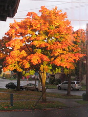
Autumn leaves in Stevens Place (Triangle) Park, 2006. Photo by Wendi.
The Beacon Hill, Seattle Pool on Flickr doesn’t contain a ton of photos, but those it does have are quite nice. Some of the photos of downtown and mountain views are particularly beautiful, and ought to make your friends from other neighborhoods a bit jealous. Photographers, please consider adding your photos of the Hill to the pool. I’m sure many of us would love to see them.

Discuss the bus over pancakes

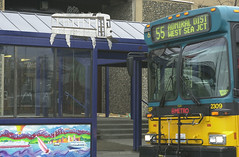
Metro bus in West Seattle -- thanks Seattle Municipal Archives!
We posted earlier about this Saturday’s pancake breakfast, and about potential bus service changes in Southeast Seattle. Today, Jodie Vice of Beacon Hill Pedestrians posted some further information to the mailing list that allows us to combine both topics:

There has been quite a bit of discussion about bus service changes when light rail comes on board. It would be great to have a discussion about this and fill out our surveys as a neighborhood! I’ve contacted Metro and they are sending me about 50 surveys (in multiple languages) to hand out at the Pancake Breakfast THIS Saturday at El Centro – 9:30AM.

A bus service and light rail discussion will go hand-in-hand at our forum on creating a town center, because you can not create a “town center” without adequate access by ALL modes. We have an amazing opportunity with the light rail to be more connected to southend neighborhoods and downtown, but bus service is still crucial for local trips.

The current Metro plans include a potential crosstown route that will connect the Hill with West Seattle, possible changes to the 38 to eliminate redundant service once the light rail opens, and more.

Thanks Jodie and BHP!

Let Metro know!

King County Metro is conducting a survey concerning potential changes to a number of routes that service Beacon Hill and the surrounding area. Service changes are being considered for many routes, including the 36. Potential cancellation is being considered for routes 7X, 32, 34, 35, 38, 39 , 42, 42X, 126, 194, and 195.

Take the survey online or mail in the printed form if you received one. Completed questionnaires are due by Nov. 6, 2008.

Thanks to Willie Weir for bringing this up on the list.

Cleveland students dodge drivers daily

The Rainier Valley Post has an article about the pedestrian-unfriendly situation around Cleveland High School, where narrow sidewalks, a lack of crosswalks, and speeding cars make the walk to and from the bus stop less than safe.

The “Critical Crossings” site mentioned (but not linked-to) in their article is available here. Thanks for forwarding this link, Ezra!

Despite the blog’s name, the Post has a fair amount of Beacon Hill coverage; if you want to go directly to those posts, go here.

Car break-in at 17th and College

Reported this evening on the Beacon Hill mailing list: a car break-in at 17th and College. Apparently 3 juveniles have been casing the neighborhood cars lately, so keep your eyes open and don’t leave valuables in your vehicle. Remember, if you see anything wrong, call the police and 911 in particular; the SPD uses these calls to determine service levels in the area, so they need to hear from you, even if you think that they won’t be able to help.

Shooting at 16th and Spokane

A flurry of posts on the neighborhood mailing list Sunday reported hearing gunshots in the area of 16th Ave S. and S. Spokane early Sunday morning. The P-I has the details: a 17 year old was shot in the leg after he and his girlfriend “exchanged words” (sounds so civilized, doesn’t it?) with the occupants of an SUV. As of yet, the SUV and its occupants have not been found.

Thanks to Ezra Klug for pointing us to the P-I report!