Tag Archives: past and present

Past and present: Engstrom’s Pharmacy

Engstrom's Pharmacy, 3067 Beacon Avenue, in 1959. Photo courtesy of Seattle Municipal Archives.
The same location today. Hello Bicycle is in the old pharmacy location. Photo by Wendi Dunlap.

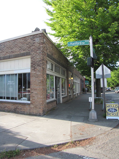
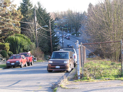
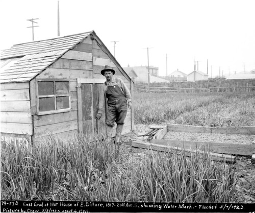
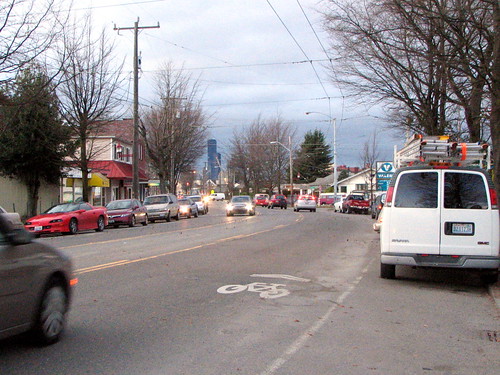
This is the intersection of Beacon Avenue South and South Hanford Street, looking north on the west side of the street. Beacon Hill is apparently much greener than it once was, at least as far as street trees are concerned. You can see that the 1959 view shows no trees at all.

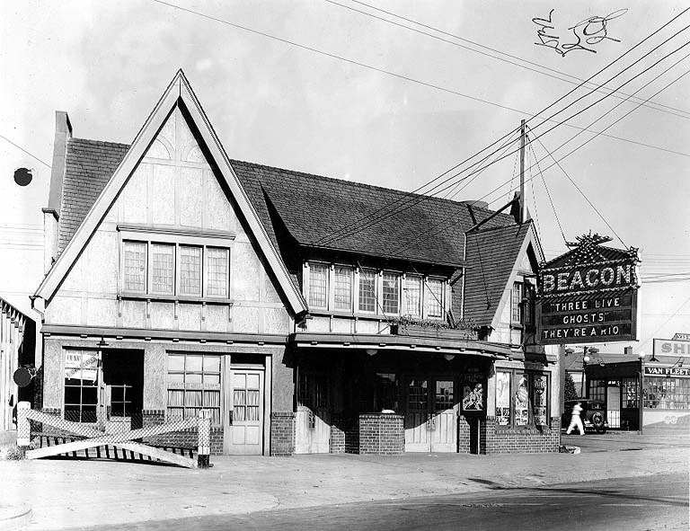
Another notable difference between Beacon Hill then and now is the pharmacy. The Hill currently has no pharmacies, but in the past there were quite a few, including Engstrom’s where Hello Bicycle is now located. North Beacon residents could easily walk to their local drugstore for prescriptions or — as the sign on the front of the old pharmacy advertises — Carnation Ice Cream.

Nelson’s Gifts is also gone, unfortunately replaced by a completely blank storefront. (We’re told it’s an art/design studio.) On the other hand, the shop one door north of the pharmacy is now exactly what it was in 1959: a barber shop.

Past and present: Beacon Avenue streetlights

Beacon Avenue South, looking northward from roughly Beacon and Stevens, February 24, 1955. The photo was intended to show the street lights. Photo courtesy of Seattle Municipal Archives.
Nearly the same shot, taken on January 11, 2011 in the falling snow. Photo by Wendi.

It was difficult to match this image exactly because, though you can’t see from the photo, the snow was falling heavily and the photographer’s fingers were freezing. However, they are a fairly close match.

The Mobil Station on the left is now an auto repair shop that looks quite different, but if you walk by and look behind the building, you can see an old Mobil “Red Pegasus” sign. The house beyond the Mobil station is now the Beacon Hill Library. The sign on the corner that advertised the Mobil is in the same location today, and may be the same structure.

The trees that now grace the planting strip on the east side of Beacon, as large as they are now, weren’t there at all in 1955.

The trolley wires are still intact for the use of Beacon Hill’s trolleybuses.

Past and present: Chickens in the basement

The old Fire Station No. 13 at 14th Avenue South and South Massachusetts Street, about 1915. Photo from the PEMCO Webster and Stevens Collection, MOHAI. Used by permission.
The old fire station building still exists, with some changes. Photo by Wendi.

This early 20th century firehouse on 14th avenue still remains, camouflaged as a residential building. Look closely at the dormer on the roof and you can see siding that matches the siding in the 1915 picture. Other details have been changed over the years, but the building is still clearly recognizable as old Station 13.

My attention was drawn to the building by this interesting letter posted in the Seattle Municipal Archives Flickr Feed:

Image courtesy of Seattle Municipal Archives.

Fire stations back then had to house horses, so the manure storage issues are not surprising. But the chickens in the basement were apparently not expected in a proper firehouse.

Fire Station 13 opened at 14th and Massachusetts on October 10, 1904, in what was, at that time, the center of Beacon Hill’s residential neighborhood. Over the next couple of decades, development on the Hill shifted further south, and the Fire Department changed from using horses to using motorized vehicles. These changes necessitated the building of a new station that would be more centrally located to serve Beacon Hill, and more suitable for the new vehicles. The old firehouse remained in service until the new station opened at the intersection of Beacon Avenue South and South Spokane Street in 1928. That building is a Seattle historical landmark that remains in operation as a fire station to this day.

The current Station 13, opened in 1928. Photo by Jason.

A view from Beacon Hill, past and (almost) present

A view of downtown and what is now the stadium area from North Beacon Hill, 1959. The most visible buildings are King Street Station and the Smith Tower, though other recognizable buildings still exist today. No freeway yet! Photo courtesy of the Seattle Municipal Archives.
A relatively close match to the 1950 view, taken in October 2008 by Bridget Christian, and found in the Beacon Hill Blog photo pool on Flickr. The camera is pointed slightly more to the left than in the old picture. You can still see the King Street Station tower here (partially hidden by another building) and the Smith Tower is still here as well, but blends a bit into the building behind it. Neither building dominates the modern view like it did in the 1959 view.

Beacon Hill past and present: Hinds, 14th, and Columbian Way

Hinds and 14th near Columbian Way, December 1956. Courtesy of the Seattle Municipal Archives.
14th and Hinds near Columbian Way, 2009.

There are a few changes from the 1956 photo to today, though the site is still clearly recognizable. This is just north of where Columbian Way carries the I-5 and West Seattle Bridge ramp traffic up toward Beacon Hill.

In the 1956 photo, there are much fewer trees and plants than we see in the modern view. The empty lot on the left side of the old photo is now the big apartment building at Columbian and Spokane, though it’s hidden behind trees in the new photo. The Columbian/Spokane intersection is rather busy now, but there’s no obvious traffic signal there in the 1956 photo.

The sidewalk on the right side of 14th no longer exists; the space is now blocked by a chain-link fence. And the car turning right onto Columbian at the bottom of the hill is doing something that is no longer legal; 14th is a one-way street going northbound in this area now. However, while I was taking the current-day photo, a car sped past me, down the hill, and took the right turn anyway.

Here’s another 1956 photo of this location:

Hinds and 14th near Columbian Way, December 1956. Courtesy of the Seattle Municipal Archives.

Beacon Hill past and present: Hothouse no more

East end of Antonio Ditore's hothouse, 1817 21st Avenue South, showing the high water mark after a flood in May, 1923. Courtesy of Seattle Municipal Archives.
The same site today, no longer growing much.

At first glance this is one of the less-recognizable past/present photos we have. In 1923, there was a considerable amount of farming in this lower Beacon Hill/upper Rainier Valley area, an Italian neighborhood, but now this spot just off Rainier Avenue, in the 1800 block of 21st Avenue South, is just a big ugly warehouse.

Still, something has survived. See the apartment building behind Mr. Ditore’s hot house? If you move just a bit further north on 21st, you can see it:

It’s the blue apartment building shown here. The house directly south of the apartment building made it to the 21st century, but, sadly, was just recently demolished. (You can still see it — a charming little bungalow — in Google’s Street View, though. The house seen in our photo just south of the apartment building is not the same house — it’s one lot further south.)

The Polk Directory for Seattle in 1923 lists Antonio Ditore, a gardener, and his wife Grace residing at this address. Though the 1923 photo is captioned “E. Ditore,” this seems likely to be Antonio. You can read more about Antonio Ditore, one of the farmers who sold at the Pike Place Market on its opening day in 1907, and see a picture of him years later with his garlic crop. (Scroll down to the post by John Ditore.)

Beacon Hill past and present: movies on Beacon Avenue

Beacon Avenue South, just north of Bayview, facing south.
Beacon Avenue in October 1949, just north of Bayview, facing south, near the current location of Baja Bistro. Courtesy of the Seattle Municipal Archives, item 41958.
The same street, almost 60 years later in February 2009.

Some of the sadder losses to Seattle are the neighborhood theaters that used to exist in just about every part of the city, including Beacon Hill. On the left side of the “past” photo, you see the Beacon Theatre at 2352 Beacon Avenue South, then showing a double bill of Gary Cooper and Patricia Neal in The Fountainhead, and Glenn Ford and Ida Lupino in Lust For Gold.

The Beacon was previously the Grey Goose Theatre, and featured a pipe organ, installed in the 1920s to play music with the motion pictures of the day. The theater was demolished in 1964.

The 1949 photo looks very different from the modern scene on the left side of Beacon Avenue, but the right side is remarkably unchanged. The house with the vertical stripes still exists, as does the retail building to its left (though it has had changes to its façade). McKale’s service station is now a 76 gas station (just beyond the edge of the photo), but sadly, full-service gas stations have also gone the way of the old-time neighborhood movie theater.

Beacon Hill past and present: Streetcar tracks on Beacon Avenue

Looking north on Beacon Avenue, just south of South Stevens Street, in March 1934. Courtesy of the Seattle Municipal Archives, item 8675.
The same intersection, late afternoon in January 2009.

As Seattle begins to build new streetcar lines, it saddens me to think of all the streetcar lines we once had that were later ripped out in favor of buses. In the 1934 picture here, we see streetcar track work on Beacon Avenue, just south of Stevens. The site is still clearly recognizable today; particularly noticeable in both pictures are the brick apartment/retail building on the left (now home to Yoga on Beacon), the sign marking then Texaco/now Valero, and the white house just beyond the gas station.

The trolley wires overhead in the new photograph mark the last remaining vestige of our streetcar: the electric trolley buses that replaced it.