Map by SDOT.The Seattle Department of Transportation (SDOT) wants you to know what’s in the works for the streets and sidewalks on North Beacon Hill. All interested neighbors are invited to a Project Open House at 6 p.m. at Beacon Hill International School, 2025 14th Ave. S.
Planned improvements include a new sidewalk on Beacon Avenue South, changes to the intersection at Beacon Avenue South and 14th Avenue South, curb bulbs at 14th and South College Street, and a new ramp on the Holgate overpass.
Construction of the improvements is scheduled to take place starting next summer.
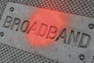
Photo by Gavin. St. Ours via Creative Commons/Flickr.Upping Technology for Underserved Neighborhoods (UPTUN) needs your help by signing a letter requesting changes that would make it easier for new broadband investments to come to Beacon Hill (and other neighborhoods), improving the speed and reliability of broadband service available to Beacon Hill neighbors.
Here is an appeal from UPTUN’s Robert Kangas, asking neighbors to sign a letter to the Seattle Department of Transportation. To sign the letter, post here with your name (real name, please) and your affiliation — for example, “John Doe (Beacon Hill resident)” or “Jane Doe (Owner, Doe’s Beacon Hill Widgets).”
Hey all, UPTUN’s going to be sending a letter to SDOT to try to force some change to the Director’s Rule that’s effectively blocking new broadband equipment from rolling out in Beacon Hill and the other underserved areas of Seattle. Most of us are stuck with the choice of a cable provider or nothing for high-speed internet. Well, we’re all tired of it. It’s time to take action.
We’re looking to get as many cosigners as possible before we stick copies of this in the mail on Saturday. Will you add your name to the list of supporters of this letter? The more supporters we get, the better the chances of a good, timely outcome. The time to act is now.
Will you put your name down? Will you get your fellow neighbors / nearby business owners to do so, as well? If you’re going to do so, please give me your name and what organization / business or part of the city you belong to. For example: Robert Kangas (UPTUN member) or Robert Kangas
(Beacon Hill resident).
Barring rainy weather, the Seattle Department of Transportation (SDOT) is planning to work on South Spokane Street between 16th Avenue South and 19th Avenue South this Sunday, April 28. During the work, from about 5 a.m. to 5 p.m., the street will be restricted to a single lane in each direction. there will be a traffic officer on site to guide travelers through the busy intersection of South Spokane Street and Beacon Avenue South.
SDOT will restripe the roadway to install left turn lanes at the Beacon and Spokane intersection, to improve traffic efficiency as well as to allow for safety improvements and better connections for the neighborhood to Jefferson Park.
In the future, SDOT and Seattle Parks will improve the intersection of Spokane Street and Lafayette Avenue South, adding a pedestrian crossing island, crosswalks, curb ramps, a stairway and a path to access Jefferson Park. These improvements are part of the Beacon Hill Neighborhood Greenway project to improve safety for pedestrians and bicyclists.
You may notice a lot of new trees like this one on North Beacon Hill. These are two of the 300 or so trees that the Seattle Department of Transportation is planting along some of our neighborhood streets this month through the SDOT Community Tree program.
The trees pictured here, on 17th Avenue South, are Paperbark Maples, which are known for their decorative peeling red bark and for spectacular autumn colors. Other trees offered to the neighborhood included Serviceberry trees and American Hornbeams.
One street on Beacon Hill will be a bit less bumpy after this weekend. The Seattle Department of Transportation (SDOT) will resurface South Myrtle Street from 35th Avenue South to just west of 32nd Avenue Sout this weekend, February 18 and 19, from 9 a.m. to 5 p.m. each day. According to info from SDOT, “The pavement on this stretch of Myrtle Street is in poor condition. Resurfacing will improve roadway life, ride quality, and above all, safety for all roadway users—transit, general vehicular traffic, and bicyclists. This work is part of SDOT’s annual arterial street paving program.”
The full width of the street is to be repaved, with one lane left open in each direction for street traffic. There will be a police officer on site to assist navigation through the construction area. Pedestrian paths will remain open.
If the forecast calls for rain, the project may be rescheduled.
Can you identify this landmark? If so, you should enter our contest. Photo by Wendi.You can still win a NAMSAYIN #36 bus t-shirt and a $50 gift card to The Station coffee shop (and, folks, that’s a lot of potential caffeine!) if you’re the first person to identify the 16 locations pictured in our contest post from earlier this week. Better work fast, though — we already have some guessers who are very close to getting all of them.
* * *
The Seattle Department of Transportation wants to know “what you think about transit in Seattle and how it could be better.” You can tell them by taking their survey. It’s fairly short.
You might have noticed sheep baa-ing somewhere on Beacon Hill lately.
* * *
Dylan Ahearn mentioned it the other day, but here’s a reminder: Tomorrow (Saturday) is the Walk & Bike Beacon Hill Neighborhood Transportation Summit. It’s a neighborhood meeting to discuss ways to improve safety and mobility while walking and biking on Beacon Hill. The event is from 10:00 am to noon at Beacon Hill International School, 2025 14th Avenue South. Activities will include designing safe walking and biking routes, learning about bike safety for children, and more. Refreshments will be served. All ages are welcome. For more information, please contact Frederica Merrell, frmerrel@seattleschools.org.
* * *
If you’re already thinking ahead to Christmas, you might want to get your Christmas tree right here in the neighborhood. No, don’t chop one down in the Cheasty Greenbelt, please. Instead, you can get one from El Centro de la Raza. Trees will be available at their lot Wednesday through Sunday, starting November 26 and running through December 19. Order before the 26th and there will be a discount. There will be 2′-7′ Grand and Noble Firs, live trees, and 20″ and 30″ wreaths. Purchases will support El Centro’s many programs. El Centro is located at 2524 16th Avenue South.
Photo by Two Ladies & Two Cats.Ryan Harrison sent this announcement with information and an invitation from Beacon BIKES!:
As many of you know, there is a growing movement among Beacon Hill residents interested in safely getting people of all ages and abilities around and to destinations within our neighborhood on foot and bicycle. This propelled Beacon BIKES!, a growing group of community members, to obtain the knowledge and expertise of a consultant to bring our collective vision to fruition. (Links available describing some of our ideas can be found on the September 3rd posting on this blog.)
Friday, we chose Alta Planning + Design as our consultant from among three enthusiastic applicants. Beacon BIKES! believes that pedestrians and cyclists encounter similar obstacles in getting around our neighborhood and that facilities that address both modes make the most sense. This philosophy is in line with Alta’s belief in “integrating all modes of travel (including walking and bicycling) into the daily lives of residents and creating healthy, safe, and sustainable communities.â€Â Most importantly, they offer an interactive approach geared to keeping the neighborhood informed and involved throughout the process.
All this is great news, but in order for this to work, we’ll need anyone and everyone to chime in at our monthly Beacon BIKES! meetings to make this a uniquely Beacon Hill plan. The next meeting will be held at the community room of the Library at 6:30 PM on Monday, September 13th. SDOT representatives will be in attendance, so the more Beaconites there, the more seriously our work will be taken. If you’re not involved already, you will want to be after this meeting!
In addition, there will be opportunities to participate through community forums, walks and other interactive outings to make this circulation plan for us and by us.
As always, you can prepare for the next Beacon BIKES! Family Bike and Pedestrian Circulation Plan meeting by visiting our Facebook page: Beacon BIKES!
You may also contact Sandra Woods or Brian Dougherty of SDOT and our City Council members to let them know you are a participant in and support our Family Bike and Pedestrian Circulation Plan.
Be sure to check back to the blog for updates. We hope to see many of you at the meeting.
Later this month, the Seattle Department of Transportation (SDOT) will begin work on the repaving and rechannelization of 15th Avenue South between South College Street and South Spokane Street. (We posted about this project when it was getting started last year.)
The project to improve 15th will include include traffic lane reconfiguration along with pedestrian and bicycle improvements, including:
Resurfacing the asphalt pavement on 15th between Beacon Avenue South and South McClellan Street.
Installing new curb bulbs and ramps at 15th and South Lander Street.
Adding sidewalk improvements at Beacon and McClellan.
Adding two new marked crosswalks at 15th and Lander.
Installing pedestrian warning signs at 15th and McClellan.
Retrofitting existing ADA ramps with tactile (detectable) warning pads.
Adding new bike facilities between College and Spokane.
SDOT will be removing parking from one side of the street in each block, using alternate-side-of-the-street parking as a traffic calming technique. Additionally, there will be a much-needed right-turn-only lane at the intersection of 15th Avenue South and South Spokane Street, when going southbound. You can read more about the rechannelization here.
Work on the project is scheduled to begin in mid-July and continue through September. You should expect lane closures, pedestrian detours, parking and loading restrictions, and the usual construction noise and mess. More information about specifics will be coming soon.
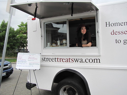
Look, but don't pick. Photo by Joel Lee.The Street Treats van visited the intersection of Beacon, Lander, and 16th on Friday night, bringing ice cream and baked goods. Photo by Wendi.Workers from SDOT work on the pavement at Beacon and Forest, where a new crosswalk with flashing lights will be installed later this summer. Photo by Jason.
Since the light rail station opened last summer, the crosswalk at Beacon and Lander has become the busiest on Beacon Hill. The majority of the people exiting the station are headed west to go to the bank, Red Apple, the southbound bus stop, or home. All of these people must cross Beacon, and many get very creative in the process. Because the crossing is way out at the corner and runs diagonally to the corner away from Red Apple and the bus stop, many people choose to just cross through the middle of the street. Because the crosswalk—which now has flashing beacons and signage, but once only had markings on the pavement—is at the intersection with Lander, there is not only north-south traffic moving through but also people turning onto Beacon from Lander. With the long crossing, the multitude of car approaches, and the scurrying light rail riders, it is ripe for an accident.
The other day I camped out at the crosswalk from 5:00-6:00 pm and filmed about 16 pedestrian crossings when cars were around. I put them together and, with very little editing, made this video:
This was not a “best of” video, but simply what you see at every rush hour here. After bemoaning the miserable state of our most popular Beacon crossing, I started to think about how the pedestrian infrastructure at all the other light rail stations in Seattle seemed satisfactory and even exemplary. Yesterday I decided to take a ride on the light rail and check out each station and then do a little compare and contrast with what we have been dealt. The results from this foray are here:
Apparently Sound Transit is only responsible for putting things back the way they found them, and Seattle’s Complete Streets Ordinance—which requires attention to pedestrian safety among other things—does not apply to them when they do their repave this summer. The Seattle Department of Transportation (SDOT) has been working with Beacon BIKES! to improve this crossing, but they have limited funds. I am suggesting that Sound Transit work with us and SDOT to improve this crossing as part of the repave this summer. If you want to get involved please email me at dsahearn@gmail.com, and attend the next Beacon BIKES! meeting on Monday, June 21, at 6:00 pm at the Beacon Hill Library, 2821 Beacon Avenue South.
Be Safe!
(This is Dylan’s first post for the Beacon Hill Blog. Thanks, Dylan! — Editor.)