Biking on Beacon: Greenway edition

New wayfinding signage like this is found on the new Beacon Hill Greenway. Photo by kashgroves in the Beacon Hill Blog photo pool on Flickr.
We at Beacon B.I.K.E.S. (Better Infrastructure Keeping Everyone Safe) love us some Neighborhood Greenways.

What are Neighborhood Greenways, you may ask?

Neighborhood Greenways are quiet residential streets that are optimized for pedestrian and bicycle travel. The idea is to have routes that connect our neighborhood to itself along streets that are safe for those 8 to 80 years old. The bike lanes on the arterials are only going to be used by a small minority of the neighborhood; Neighborhood Greenways, on the other hand, can be conformably used by anyone!

What does a Neighborhood Greenway look like?

The best introduction to Neighborhood Greenways is this video from Portland. Basically, a residential street that connects neighborhood destinations is outfitted with wayfinding signs, paint markings on the street (like the “sharrows” on 15th), some traffic calming (speed bumps, traffic circles), improved crossing treatments at intersections with arterials, and maybe some trees to spruce the place up.  The result is a street that gives that small town feel in the middle of the big city. Traffic is calmed where people want it calmed (in front of their homes!), bikers are off the arterials where conflicts with traffic are good for no one, use of the public space provides more eyes on the street and thus reduces the likelihood of crime, and you can bike to the park or to school with your kid without worrying for their lives.

The Beacon Hill Family Bicycle and Pedestrian Circulation Plan is basically a big network of Neighborhood Greenways on Beacon Hill.  The first Greenway route (18th Ave South/17th/Lafayette) is currently being implemented.  The wayfinding signs are up (you may have seen them around the library), the paint will be going in within a month, and as of yesterday SDOT planted about 70 trees along the route. I snapped some photos this morning of our new friends on the hill. Its not a Greenway without the Green, so we are excited that the city agreed to help us out with the trees!  Neighbors along the route with a spot for a potential tree in their planting strip were offered a choice of a couple different species of trees or no tree at all.  SDOT planted and will water the trees for 3 years until they are established.  SDOT will also prune for the life of the trees.  The trees planted were paperbark maples, Persian ironwood, “Royal Raindrops” crabapples, “Native Flame” American hornbeam, and “Emerald Sunshine” elm.

If you get the chance, take a stroll down 18th and see how our first Greenway is coming together!

Next Beacon B.I.K.E.S. meeting is Wednesday November 16th, 6-8pm at the library.  All are welcome!

You’re invited to a virtual “ride along”

Next Tuesday, November 15, everyone is invited to “ride along” with Seattle Police officer Nate Shopay to get a taste of life for a patrol officer on Beacon Hill. That’s right, everyone. There’s room for the whole neighborhood, since it’s a virtual ride along — a Tweetalong! Shopay will use Twitter to post his experiences on a typical day patrolling Beacon Hill between South Orcas Street and South Othello Street, during the second watch shift from 10 a.m. to 5 p.m.

The Seattle Police Twitter account is @SeattlePD. On the day of the Tweetalong, search for #tweetalong on that account to follow the tweets.

Free evergreen trees still available

Shore Pine. Photo by Art Poskanzer via Creative Commons.
The Trees for Neighborhoods program has extended the application deadline for Seattle residents to receive free trees to plant in their yards. Apply online here. The remaining available species, all conifers, include deodar cedar, Western red cedar, weeping Alaska cedar, and shore pine.

Trees can be picked up this Saturday, November 12, at Rainier Beach Urban Farm and Wetlands, 5513 S. Cloverdale Street .

If conifers aren’t the trees of your dreams, or if you want to plant street trees, you’ll need to wait until next fall when applications will re-open for other tree species and for street tree permits.

El Quetzal, La Esperanza approved for new liquor licenses

Two new liquor licenses have been granted to Beacon Hill businesses.

El Quetzal, at 3209 Beacon Ave. S., received a license of the type “Spirits/beer/wine restaurant service bar; off-premises sale of wine.” This was an additional liquor license class beyond their previous license, and allows the restaurant to sell wine by the unopened bottle for off-premises consumption.

La Esperanza de Seattle, at 2505 Beacon Ave. S., received a Grocery Store – Beer/Wine license.

Opinion: Mountains-to-Sound Trail doesn’t end well

Amazing views greet cyclists on the Mountains-to-Sound Trail. Photo by Willie Weir.
by Willie Weir

(This article is cross-posted, with permission, from the blog Yellow Tent Adventures. — Ed.)

Recently ribbons were cut and speeches were made at the opening of the new segment of the Mountains-to-Sound Trail. Any additional trail miles that provide needed access for bikes and pedestrians is cause for celebration. Except that the Mountains-to-Sound Trail now officially ends at a blind corner of a very steep hill.

Holgate, which rises to and descends from Beacon Hill, is legendary on this side of the city. It is the type of road that even some seasoned cyclists choose to avoid. If you are descending it from the top of Beacon Hill, you can easily hit 40mph without a single pedal stroke. You just take the lane and fly. The road crosses I-5, and at this point as a cyclist, you need to be hyper-aware as you dump out onto the left lane of traffic. Cars turning from Airport Way S. are speeding to make the light at 6th Ave. S. Many motorists like to make a left hand turn across your path as they exit the Office Depot. And the road surface is a photo op for the “repave our streets” campaign.

On the way up Holgate you are in a narrow lane with a high curb on your right as you climb over I-5. The thought that a car clipping you could send you catapulting onto the freeway is enough to have many cyclists choose to ride on the left hand sidewalk and then cross over at the blind corner as the sidewalk ends. Sounds fun, doesn’t it?

Can you imagine parents riding their bikes along with their two young kids tackling any or all of this? It sounds rather nightmarish.

And yet it is a possibility. The Mountains-to-Sound Trail is a separated recreational path. The type of trail that is desirable for riders and walkers who aren’t comfortable in traffic. The recently opened extension expands the trail from 12th Ave. S. to Holgate. The path is a delight and offers beautiful vistas of downtown Seattle. I had a hard time wiping the grin off my face the first time I rode it.

The end of the Mountains to Sound Trail at the blind corner of Holgate and Beacon Ave. S. Photo by Willie Weir.
My grin faded at Holgate. The sign simply reads, “End. Mt. to Sound Trail” That’s it. No more information.

What is the family with their two kids going to do? They’ll look at the option of crossing the road at the blind intersection and climbing the steep hill to their left. But what’s up there? They don’t know, because they are visiting from Spokane or Missoula and they don’t know that at the top is the business district of Beacon Hill with a light rail station, bus connections, stores, restaurants, a library, and a huge park. No, to them it’s just a big scary hill to destinations unknown.

Then they’ll look down the hill and think, “The Sound is that way.” They’ll opt to walk their bikes down the sidewalk because the hill is steep and their kids are scared. This is good. Because that sidewalk ends in a flight of stairs. To their credit, SDOT has posted a sign regarding this about 200 feet before impact.

The sidewalk down Holgate quickly becomes a stairway, dangerous for bikes. Photo by Willie Weir.
Now our visiting family is stuck. Because to continue forward means having to lift their bikes onto a narrow road with speeding traffic and “take the lane, kids.” Beyond this dangerous move there is no signage letting them know that they are three blocks away from the bike path that runs parallel to light rail.

But I’m guessing at this point our family will opt to turn around and push their bikes back up the sidewalk. The kids will be crying and Mom and Dad will think, “This is unsafe and crazy.” They will finally reach the trail and backtrack from whence they came.

What the family doesn’t know is that the Mountains-to-Sound Trail will eventually be completed. There will be a switchback trail that crosses under the freeway and connects to the bike trail and light rail station at Royal Brougham. But construction of that section isn’t even scheduled yet… so it’s years away.

In the meantime, information needs to be posted that gives everyone an option. Experienced city traffic cyclists can take a right at Holgate and shoot into the Sodo District or take a cautious left and climb to the Beacon Hill business district. Others can backtrack and follow the bike route signs to downtown, or be routed that way to begin with.

The dangerous conditions at the blind curve where Holgate becomes Beacon Ave. S. need to be addressed. This is now more important than ever! This is one of the few accessible routes up to Beacon Hill and it should be made safe for everyone.

The Mountain-to-Sound Trail extension is great! It will be better when it is finished (South Seattle’s missing link?). But until then, we need signage that explains the current conditions, and improvements that give everyone safe options. Without them, the ride doesn’t end well.

Election Day: Have you mailed your ballot?

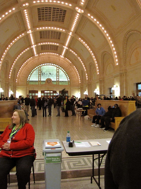
It’s Election Day, and while the focus on one specific election day has dimmed somewhat since we switched to vote-by-mail, it’s still the deadline for turning in your ballot. Ballots must be postmarked today or returned to a ballot drop box by 8:00 pm to be counted. (If you get your mail to the mailbox after the final pickup of the day, you won’t get a November 8 postmark, even if the final pickup is before 8 p.m. Be careful to check pickup times.)

If you would rather not use a stamp to mail in your ballot, you can drop off your ballot at one of the county’s official ballot drop boxes. The nearest ones to Beacon Hill are located downtown, at the King County Administration Building (500 4th Ave), and in the International District at the accessible voting center at Union Station (401 S. Jackson St.). There are no drop boxes in Southeast Seattle.

If you have lost or damaged your ballot, or if you are one of the up to 21,000 voters who did not receive ballots, you can vote the old-style way in a voting booth at the accessible voting center, until 8 p.m. tonight. Bring your identification. However, the Union Station voting center is one of only three in the entire county, so be aware that there may be lines at peak periods. Get there early if you can.

If you want to remind yourself about the issues in this election, you can find the statewide candidates and ballot measures you’re eligible to vote on by filling in the form here. Local candidates and ballot measures can be found by filling in the “Your Voter Guide” form here, or reading the online voters’ pamphlet.

The first batch of results will be posted to the King County Elections page tonight at 8:30 p.m., and thereafter at 4:30 daily. Unfortunately, the 8:30 batch is the only batch of results that gets posted on Election Night these days, making Election Night parties a bit less suspenseful.

Last November, voters at the Union Station accessible voting center waited as much as three hours to vote. However, there was no wait to use the ballot drop box. Photo by Wendi.

Metro proposes deletion of Routes 38 and 42

A Route 38 bus on South McClellan. Photo by Oran Viriyincy in the Beacon Hill Blog photo pool.
King County Metro has released proposed service changes for June, 2012. Among the changes are two in or very near Beacon Hill, the deletion of Routes 38 and 42.

Route 38 currently is a short route that runs between 15th Avenue South and Martin Luther King Jr. Way South on South McClellan Street. Previously, it ran down to Sodo, but since the opening of the Link light rail line in 2009, it has been truncated to the shorter route. The 38 runs only between 9 a.m. and 4 p.m., generally every 20 minutes.

The proposal to delete the 38 cites “low performance” as the reason for the deletion:

“Route 38 performance is in the bottom 25 percent of routes that do not serve the Seattle core on the measure of passenger miles per platform mile.

“Consistent with our Service Guidelines, Metro plans to use resources from low performing routes to relieve overcrowding, improve on-time performance, and increase the number of trips on underserved corridors.”

The alternative transportation suggested for 38 riders is Link, either at Mount Baker Station or Beacon Hill Station. Either station is less than one-half mile from the 38’s current stops, however, there is a very steep hill between 23rd Avenue South and Mount Baker Station. Link trains do run more frequently and for longer hours than the 38 buses do.

Protesters at a King County Council town hall meeting in Columbia City in 2009 expressed their opinions about Metro service changes. Photo by Wendi.
Route 42 runs in Rainier Valley from Pioneer Square to Columbia City. Currently the 42 runs only once an hour between 9 a.m. and 5 p.m. on weekdays, and not at all on weekends. Similar to the 38, Metro says “Route 42 performance is in the bottom 25 percent of routes that serve the Seattle core on both measures Metro uses to rate performance (rides per platform hour and passenger miles per platform mile).”

Alternatives Metro suggests for 42 riders, depending on whether they are going to Columbia City, Martin Luther King, Jr. Way South, Rainier Avenue South, or South Dearborn Street, include Route 7, Route 34, Route 39, Route 8, or Link light rail. Most stops are less than one-quarter mile from the current stops, and Route 8 serves the same stops as Route 42.

A previous attempt to delete Route 42 caused some controversy in 2009. Representatives for the Asian Counseling and Referral Service on Martin Luther King Jr. Way South at South Walden Street argued that the route is necessary to serve their clients, and that clients who are elderly or disabled would not be able to walk to the nearby light rail stations.

Seattle Transit Blog recently posted two articles, “The Case Against the 42” and “Ridership on Route 42” that argue that the route is redundant and rarely used:

“It’s demonstrably unnecessary for mobility, it’s costing a fortune, and riders are choosing in droves not to ride it. At this point, Route 42 is indefensible.”

Beacon Hill artist featured at SAM Day of the Dead

Beacon Hill artist Fulgencio Lazo (mentioned earlier this week) will have a tapete (sand painting) on display at the annual Day of the Dead celebration at Seattle Art Museum’s Olympic Sculpture Park, tonight, November 4, from 6-7:30 p.m. The park is located at 2901 Western Ave, near Pier 70 and Myrtle Edwards Park.

Banda Gozona, an 18-piece brass band, will perform Oaxacan music at the event. There will be also be art activities for all ages, and Mexican food catered by Manjares Seattle.

This video shows the process of creating one of Lazo’s sand paintings:

Spokane Street Viaduct to close overnight next week

The westbound lanes of the Spokane Street Viaduct will be closed next week between I-5 and SR 99 for continued work on widening the structure. The closures will start each weeknight from November 7-11 at 10 p.m., and will end by 5 a.m. the next morning.

During the closures, southbound traffic from I-5 will detour to the South Forest Street exit, then to to the lower Spokane Street Swing Bridge. Northbound traffic from I-5 and traffic from Beacon Hill via Columbian Way will detour via Sixth Avenue South. Be aware there may be occasional congestion.

See the project website for more information.