Trees previously planted along a Beacon Hill greenway. Photo courtesy of Dylan Ahearn.Would I please shut up with the bike stuff!? Â Why, yes I will. Â Let’s talk about street trees!
As noted in this previous post, Beacon BIKES has been working with SDOT to plant trees along our planned Neighborhood Greenway routes.  We had a very successful effort last fall planting 70 trees along 18th Avenue South.  Now we are working with SDOT to plant 300 more trees this March.  The City plants the trees, waters them for three years, and prunes for the life of the trees.  Home owners get to pick among three tree types or choose no tree at all.  It is called the SDOT Community Tree program, and you can find out more about it here.
If you have questions about the program email me or come to the next North Beacon Hill Council meeting (March 6th, 6:30-8:00 pm, Beacon Hill Library) where we will be presenting a little more info.  The planting is scheduled for mid- to late March and we will be planning a community tree planting day to plant a few by hand in the same time frame. SDOT has already marked some of the proposed planting locations; you can check out the flags along 14th Ave S to get a feel for how this program can really improve a street for all users.
If you live north of Lucile and would like a tree or two planted in your planting strip let me know and I will forward it to the City.  If you would like a tree for your yard instead of your planting strip, there is another great City program called Trees for Neighborhoods which has been posted about previously here, with more up-to-date info here.
Seattle City Councilmember Sally Bagshaw spoke at the recent Neighborhood Greenways meeting at the Beacon Hill Library. Photo by Dan Bennett.By the end of 2012 Beacon Hill residents will be able to safely walk or bike from the Mountains to Sound Trail to Georgetown on a quiet and safe residential street optimized for non-vehicular traffic.  First presented in the Beacon Hill Family Bicycle and Pedestrian Circulation Plan, this signed route (mapped here) will include safe arterial crossings at Beacon, Spokane, and Columbian, as well as pavement markings, tree planting, and other safety improvements. The 3-mile route connects six schools (Cleveland, Maple, St. George, Thurgood Marshall, Asa Mercer, and Washington), three major parks (Maple, Jefferson, Judkins), the library, and our business district with a pleasant safe street for you and your family to walk or bike along (of course, cars are still welcome for local residents).
At a January 10 meeting of Seattle Greenway Organizers at the Beacon Hill Library, Seattle City Councilmember Sally Bagshaw enthusiastically announced a set of pilot Neighborhood Greenways being planned by the Seattle Department of Transportation (SDOT) that are designed to make streets safer and more pleasant for people who live, walk, bike, and drive in Seattle’s neighborhoods.
The Neighborhood Greenways under review total 11 miles: seven miles in Ballard, Beacon Hill, Greenwood, North Delridge, Wallingford, and the University District and an additional four miles in Laurelhurst (funded by Seattle Children’s Hospital). These projects are intended to form the backbone of a new network of Greenways that effectively connect people to the places they want to go by giving them a choice to travel on quieter, safer streets around the city.
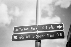
Signs mark directions on the Neighborhood Greenway at 18th Ave. S. and S. Forest St. Photo by Dylan Ahearn.
Councilmember Bagshaw, chairing the newly formed Seattle City Council’s Parks and Neighborhoods Committee, is excited to include Neighborhood Greenways on her agenda.  “Greenways connect parks and schools, community centers and neighborhood business districts. Neighborhood Greenways help with transportation, and they help with getting people where they want to go within their own communities.†(Watch a YouTube video of Councilmember Bagshaw’s announcement here.) Councilmember Bagshaw and Councilmember Tom Rasmussen, who chairs the Seattle Transportation Committee, have taken great leadership initiative on Greenways.
In case you missed previous posts here and here: Neighborhood Greenways are slow-speed, low-traffic residential streets made even more pleasant for the people who live, walk, and bike on them. By adding new park-like amenities and limiting cut-through traffic, Greenways are naturally attractive both for families, and for anyone seeking a safer, more connected community experience. By placing Greenways a block or two away from major arterials, Neighborhood Greenways create a great option for people who prefer to walk or bike away from congested streets. While many new dedicated walking and bicycling trails are beyond the reach of our City’s budget, 10 miles of Greenways can be built for the cost of a single mile of new trail, offering the potential to bring a high-quality network to all Seattle neighborhoods at a comparatively low cost. Neighborhood access by emergency service vehicles and freight delivery vehicles—and parking—is preserved along Greenways.
If you would like to get involved with Greenway planning on Beacon Hill during these exciting times please visit the Beacon BIKES webpage and come to our February meeting!
New wayfinding signage like this is found on the new Beacon Hill Greenway. Photo by kashgroves in the Beacon Hill Blog photo pool on Flickr.We at Beacon B.I.K.E.S. (Better Infrastructure Keeping Everyone Safe) love us some Neighborhood Greenways.
What are Neighborhood Greenways, you may ask?
Neighborhood Greenways are quiet residential streets that are optimized for pedestrian and bicycle travel. The idea is to have routes that connect our neighborhood to itself along streets that are safe for those 8 to 80 years old. The bike lanes on the arterials are only going to be used by a small minority of the neighborhood; Neighborhood Greenways, on the other hand, can be conformably used by anyone!
What does a Neighborhood Greenway look like?
The best introduction to Neighborhood Greenways is this video from Portland. Basically, a residential street that connects neighborhood destinations is outfitted with wayfinding signs, paint markings on the street (like the “sharrows” on 15th), some traffic calming (speed bumps, traffic circles), improved crossing treatments at intersections with arterials, and maybe some trees to spruce the place up.  The result is a street that gives that small town feel in the middle of the big city. Traffic is calmed where people want it calmed (in front of their homes!), bikers are off the arterials where conflicts with traffic are good for no one, use of the public space provides more eyes on the street and thus reduces the likelihood of crime, and you can bike to the park or to school with your kid without worrying for their lives.
The Beacon Hill Family Bicycle and Pedestrian Circulation Plan is basically a big network of Neighborhood Greenways on Beacon Hill.  The first Greenway route (18th Ave South/17th/Lafayette) is currently being implemented.  The wayfinding signs are up (you may have seen them around the library), the paint will be going in within a month, and as of yesterday SDOT planted about 70 trees along the route. I snapped some photos this morning of our new friends on the hill. Its not a Greenway without the Green, so we are excited that the city agreed to help us out with the trees!  Neighbors along the route with a spot for a potential tree in their planting strip were offered a choice of a couple different species of trees or no tree at all.  SDOT planted and will water the trees for 3 years until they are established.  SDOT will also prune for the life of the trees.  The trees planted were paperbark maples, Persian ironwood, “Royal Raindrops” crabapples, “Native Flame” American hornbeam, and “Emerald Sunshine” elm.
If you get the chance, take a stroll down 18th and see how our first Greenway is coming together!
Next Beacon B.I.K.E.S. meeting is Wednesday November 16th, 6-8pm at the library. Â All are welcome!
Jefferson Park is a wonderful community gathering space located in the heart of Beacon Hill.  It offers amazing views, brand new tennis courts, playground, cricket, lawn bowling, golfing, a community center, and soon we will have a skate park and spray pad (which would not have gotten much use this summer, somewhat diminishing the sting of construction delays).  But the irony is this community nexus acts as a physical division within our neighborhood. The golf course is not permeable by car or foot, while the park is surrounded by arterial and collector streets (Spokane, Columbian, Beacon) that are wide and unsafe to cross except at stoplight-controlled intersections.  Due to the current configuration it is difficult to access the park in a safe and efficient manner without getting in your car and driving there, which I must say, though I love my car, does take the neighborhoodiness out of things a bit—when was the last time you had a meaningful interaction with a neighbor when driving past them on 15th?
Neighbors have noticed that many people try to access the park by foot by crossing Spokane between Beacon and 15th Ave. S. (at 16th, 17th, Lafayette, and Alamo).  Though legal, crossing Spokane at these intersections across 4 lanes of fast-moving traffic with no marked crosswalks and difficult sightlines is not the most relaxing stroll to the park.  A solution proposed in Beacon Hill’s Bike and Pedestrian Circulation Plan is to create a safe pedestrian crossing at Lafayette Ave. S.  The first step to adding a new pedestrian crossing is data collection.  Within the past month folks from Beacon B.I.K.E.S. have conducted pedestrian crossing counts and even shot a nice video at the proposed crossing.
The results from the counts indicate that during peak hours around 20 people per hour will cross Spokane at these dangerous intersections.  This is considered a high enough rate by SDOT to justify a pedestrian crossing.  SDOT will soon be conducting their own counts and studies and hopefully we will get the crossing installed next year!  Of couhttp://youtu.be/dvqw7D8-6aYrse, it won’t happen without a lot of community support, so if you are interested please contactBeacon B.I.K.E.S. and send an email to Peter Hahn (SDOT director) letting him know this is something the neighborhood needs.
I have never been the long-distance bike riding type. The spandex thing is silly, the leg shaving too high maintenance. Instead I have taken a utilitarian approach to two-wheeled self propulsion. In many instances it is just the easiest way to get around. But I have begun to notice that the more I ride the more I enjoy it just for the sake of riding a bike.  Turns out it is pretty fun.
On Sunday I rode around Mercer Island for my first time. Though the ride was about 16 miles, I was having so much fun, that it felt like 5. Big water and mountain views, few cars (except for noisy I-90), tall trees, cool air, good company. I will map it next time for those who have yet to try it. But today’s post is about something else altogether great: Pizza!
Things are abuzz on Beacon Hill about the new bar at the old ROCKiT space and the Bar del Corso Pizza spot. Pizza bar and beer bar, yum! Both these spots will be along Beacon Avenue and easily accessible by foot and bike, especially if you use the newly proposed bike boulevard along 17th/18th ave. But alas, we must wait months for this fun to start. So until then, here is a safe route to the very near and very delicious Mio Posto in Mt Baker. This spot is great for its Irwin’s Pastries and brick oven pizza! If you are looking for something a little different try this safe route to All Purpose Pizza in Leschi. They serve a Pagliacci-esque pie with a smile. After all this pizza you will need that ride to Mercer Island to clear the arteries, but don’t worry, it goes by in a flash.
I was at The Station the other night having a drink with some friends (Thanks Luis!), and we got to discussing Columbia City and how much it has changed over the past 10 years. Â Today, there are a number of great destinations there including Empire Espresso on Edmunds (best latte in Seattle, though they can’t touch The Station’s Mexican mochas); Columbia City Cinema (now playing: Black Swan and a couple movies about hornets); Tutta Bella (a stopgap until we get our own brick oven pizza place); Full Tilt (old school video games and small batch ice cream… ’nuff said); a bakery, bar, toy store, etc.; and—of course—Bike Works!
Bike Works was established in the mid ’90s with the goal of promoting cycling in the underserved communities of Southeast Seattle.  When the bike shop went in, it was the only one between Capitol Hill and Renton!  They currently run the earn a bike program for kids and are generally bicycle angels in our midst. I biked there with my kids a few months ago to get some hand grips for Kai’s bike.  It was Malia’s longest ride and she did great (we took the light rail to get back).  The key to getting to Columbia City safely on a bike is Renton Ave. S. which runs between MLK and Rainier.  You can see our mapped route with videos here.
There are many reasons why Columbia City has changed so much while Beacon Hill has not (topography, demographics, arterial access) and I am sure the next 10 years will bring similar change to our community. This will, of course, have complex ramifications: some good, some bad.  One good one, that my kids will appreciate, is that our bike rides will get a little easier.
After a long holiday vacation, which, due to the blizzard in the Northeast, stretched into an even longer holiday vacation, I finally made it back to the Hill to find that indeed I am required to return to work in the new year. 🙁
An upside to this situation is that I get to hop on my bike and get back into my commuting routine. I have to admit that when I was first considering bike commuting from Beacon Hill to Downtown and back I was hesitant. Though it is only a three mile ride to Belltown from my house, there are a number of daunting hills and even scarier rivers of traffic. But after testing out numerous routes, I found one that is not too hilly and avoids a good bit of the traffic.Â
If you look on a map the most logical route to get from North Beacon Hill to Downtown is along 15th Avenue South via the Jose Rizal bridge. The problem with this is that even after last years restriping on 15th (addition of a bike lane going southbound from Jose Rizal to Beacon, and sharrows northbound), the road is still a little scary to bike along. An alternate route is to take 18th Avenue South to the Mountains to Sound Trail to Jose Rizal; this avoids the traffic and, as 18th is a gradual climb, provides one of the easiest ways to get up the north side of Beacon Hill. Once over Jose Rizal, King Street (non-arterial) and 3rd Avenue (bus and bike only during commuter hours) provide the best routes for avoiding heavy traffic. Another great way to avoid heavy traffic is to go into work early and come home early, this makes biking much safer!
I have mapped this route with accompanying video here.
According to SDOT counts, bike commuting in Seattle has doubled over the past 15 years. And with the implementation of the bicycle master plan in full gear, this ridership rate will only increase in the coming years. Hop on your bike and try this route someday to see if bike commuting is for you.
Now that the holiday season is upon us, shopping is on the minds of many. Black Friday is infamous for the crushing crowds at the box stores and the malls and now “Cyber Monday” has become a major phenomenon, as folks turn to the internet for convenient holiday shopping. Both these forms have shopping have something in common: they do not support local businesses. On Beacon Hill this is a chicken and egg issue—not much holiday shopping occurs locally because there are not many places to shop, and there are not many places to buy gifts because people tend to drive elsewhere to do their holiday shopping. But it was not always this way.
I was curled up with Images of America: Seattle’s Beacon Hill yesterday and came across this quote from Pete Caso (born 1923):Â “There were many businesses before and now there is absolutely nothing. There were four drugstores on Beacon Hill, three bakeries, five grocery stores, and all your daily shopping was done on Beacon Hill. Why did the businesses close? The businesses were there in the 1940s. They closed up after World War II, with supermalls and everybody got a car. Before those days, nobody had a car. Up until then you used the street car or you walked.”
In 1937, the east side of the 15th and Beacon Junction, now home to the ABC Supermarket and the big empty building that is Hui Intertrading, was home to Eba's Mutual Grocery, Ray's Barbershop, a hardware store, and a small Safeway. Photo from the Puget Sound Regional Archives.
Biking was also popular before the War, as evidenced by the fact that a popular bicycle repair shop (Mr. Ellis’s Repair Shop) used to exist on Beacon Avenue at the current location of La Bendicion. Because it was difficult to get off the Hill by foot, bike, or long street car ride, people stayed up here to do their shopping and the local economy boomed. Today, the Department of Planning and Development‘s answer to bolstering the local economy is density and transit oriented development. Generating more shoppers will help, but just as important is to reorient existing residents inward. One way of doing this is changing how we get around.
So before I walk up to Red Apple to get some groceries, and El Centro to pick up my Christmas tree, I thought I would share another quasi-local route to a great shopping destination that is fun for the whole family: Goodwill!
This route is safe for bikers of any level and because it uses 18th Avenue South to get back up the hill, it is not too strenuous.  I look forward to the days when I can stay on the Hill to do all my shopping; until then, I have my bike as a viable transportation alternative that forces me to keep it local (and keeps me from getting trampled trying to pick up a NERF N-Strike™ Stampede ECS™). Happy Holidays and please respond with your favorite local shopping destinations!
Map on Everytrail website, showing safe bicycle routes to MacPherson's produce market. The map includes videos with commentary about the route and reasons why certain paths were chosen.Beacon BIKES! is excited about our upcoming community-wide biking and walking information event on Saturday, November 20 (at Beacon International School, 2021 14th Avenue South, from 10:00 am until noon)! To celebrate biking as a viable option on Beacon Hill and in Seattle in general, I thought I would show how safe and easy biking can be in and around our neighborhood.
Many years ago I lived in Davis, California, which is known as the biking capital of the U.S. (Their city logo is even a bike!). In Davis, biking is just the easiest way to get around, not only because it is a dense city and flat as a pancake, but because there is an amazing bicycle infrastructure to keep biking safe for everyone. As a result, 17 percent of the population commutes by bike (compared with the less than 3 percent in Seattle). I bring up Davis because what is interesting to see is that when that many people are biking, they stop identifying as cyclists—they are just people who happen to get around town in the easiest manner available, by bike. So that is our goal at Beacon BIKES!, to make biking so safe and easy that even your grandma will want to hop on a bike to head to MacPherson’s for her afternoon errands.Â
“If we get out of our cars more often, we become more neighborhood-oriented.”
We are not a bunch of spandex-clad aggro bike advocates, but rather neighbors who want to see you on the streets walking or biking to your local destinations. If we get out of our cars (and yes, we all have cars too) more often, our options for what are viable trips change and we become more neighborhood-oriented. We go to Red Apple instead of Safeway, The Station instead of Starbucks, and we see our neighbors along the way!
Part of what we will be doing on the 20th is providing maps for safe routes to schools (and other destinations) for you and your children on Beacon Hill. We will have a bunch of blank maps; you show us where you live, and we draw you a safe route to your destination of choice. In the spirit of this, I have begun to compile a series of virtual tours of routes that I use to safely get around and off of Beacon Hill, both by myself and with my family. All the routes I map either start or end at the library or light rail station.
I use the program Everytrail to map all the routes. Here are my preferred routes to MacPherson’s (family-friendly) and Lowe’s (mostly safe, but involves biking on South College Street for a couple blocks). Clicking on these links will take you to the Everytrail website (click on the “View Full Screen” button on the bottom right of the map to get the best view of the route). For all the routes I use the following criteria:
Whenever it makes sense, use non-arterial streets or multi-use trails
Whenever it makes sense, take the least steep street possible
Try to make all arterial crossings at signalized intersections
I also frequently take advantage of the light rail to get back up the hill after biking off the hill. I have more routes already mapped and more planned for future posts. In the meantime, let me know the destinations you would like mapped in the comments section. Happy Biking! See you on Saturday!
On July 7, Mark Holland and I (representing Beacon BIKES) met with Seattle Department of Transportation (SDOT) and Sound Transit to discuss options for improving the pedestrian crossing in front of the light rail station. As it currently stands the crossing is not very safe. The crossing distance is very long, people do not use the crosswalks, traffic moves too fast, and the bus stops complicate the foot and vehicular traffic patterns. Add to this the surge of people coming from the light rail station and we have an accident waiting to happen. You can see a previous post about the dangers of the crossing here.
Sound Transit was planning to repave the section of Beacon between McClellan and Lander without improving the pedestrian crossing. Beacon BIKES got wind of this and arranged a meeting to discuss options for pedestrian improvements as part of the repave. SDOT was instrumental in setting up the meeting and convincing Sound Transit that this crossing needed to be improved (Thanks Sam Woods!!). Based on our meeting SDOT came up with the following design. The SDOT draft plan for Beacon Avenue. Click the image to load a larger, more-readable PDF of the plan.
The major features of the new design are a planted median, widened crosswalks at either end of the block, and narrowed travel lanes. The narrowed lanes would mean that buses stop in lane. In lane bus stops are being implemented all over the city as a means of speeding up the bus system. The median would have a tasteful barrier down the middle so people could not stream across the street at mid block. Instead, they would be directed to the wide crosswalks at the corners to cross. With the widened sidewalks the crossing distance would be shortened making for a safer pedestrian experience.
The design that Beacon BIKES put forward did not have in lane bus stops but did include a raised crosswalk at mid-block. Our logic here was that everyone wants to cross at mid-block to get to the bus, so why not give them an avenue to do that instead of forcing them around (also the raised crosswalk would act as a speed table and slow traffic down). SDOT did not like the mid-block crossing idea because of the relatively short distance between McClellan and Lander, but we are still hoping they will reconsider. 🙂
As is apparent from the rough nature of the design sheet, the plan is not finalized, so this is your chance to come up with an inspired idea that will make this pedestrian crossing safe and inviting while still accommodating bus, bike, and vehicle traffic.
In the meantime check out Beacon BIKES on Facebook, and come to our next meeting to join the fun. The meeting is on Monday, November 15, at the Beacon Hill Library, 2821 Beacon Avenue South.


