The Seattle Department of Transportation will close one lane of South Graham Street from Beacon Avenue South to 23rd Avenue South on November 19-20 for paving. One lane will be kept open with flaggers on hand to assist traffic through the area in alternating directions. Work may be rescheduled or cancelled if the weather doesn’t cooperate.
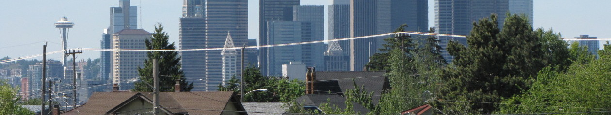
Category Archives: Getting Around
Open house to showcase pedestrian safety improvements
Planned improvements include a new sidewalk on Beacon Avenue South, changes to the intersection at Beacon Avenue South and 14th Avenue South, curb bulbs at 14th and South College Street, and a new ramp on the Holgate overpass.
Construction of the improvements is scheduled to take place starting next summer.
For more information, see the website.
Opinion: Community must work together on school boundary changes

Even if you don’t have a child in the Seattle Public School system, you are affected by this proposal. When families travel farther from home for school, they have less time to invest in our community. We have fewer eyes on the street and less of the daily interaction that makes our community so strong and interesting. We all benefit from the volunteer efforts and the small businesses started by families with kids. When families are forced to send their kids outside of the neighborhood they’ve invested so much time and money in, they may feel less committed to the community and may even decide to leave. Property values are affected by reference schools. Our homes may be worth less after this proposal is implemented because potential buyers are holding out for a better or more convenient school.
Please sign up now to “Walk the Boundaries.” It’s another important way to share feedback about the proposal. Feedback is due by October 1.
- Download the map for the school attendance area(s) you will review. Each map has a grid to use as a reference point when you submit your observations and suggestions.
- Drive or walk the boundary shown on the map. Look for portions of a school’s proposed boundary that have geographic barriers or local features that separate a specific area from the rest of the attendance area. (For example, we are recommending that the elementary boundaries in Southeast Seattle be modified so that the light rail is a dividing line.)
- Mark any issues on your map and note the reason, or note that there are no issues.
- Enter your results in the online survey. Please complete the survey one time for each school attendance area boundary you review.
While you’re “Walking the Boundaries,” remember: the City of Seattle has invested millions of dollars in Safe Routes to School and Neighborhood Greenways. The SPS proposal doesn’t take any of that valuable infrastructure into consideration.
“Walk the Boundaries” is only one part of the outreach. Please attend meetings and send letters to our school board representative,
Betty Patu; School Board President, Kay Smith-Blum; Sally Bagshaw, Chair of the City Council committee responsible for the Neighborhood Greenways; and any other elected or appointed officials you believe may be interested in this proposal.
I’m confident we can help Seattle Public Schools find a solution to the problem that works well for communities. I’m confident that Beacon Hill will work with Georgetown, Mt. Baker, Seward Park and other South Seattle neighborhoods to create a plan that meets the needs of students while maintaining strong communities. We must.
Please note: all opinions expressed or implied in this message are Melissa’s own and do not reflect the position of the North Beacon Hill Council or the NBHC Board. This topic is on the council agenda for Tuesday, October 1. Please attend the meeting at 7 p.m. at the Beacon Hill Library and share your ideas. (Melissa adds: “The NBHC does actually agree that Beacon Hill is awesome. That’s an official position.”)
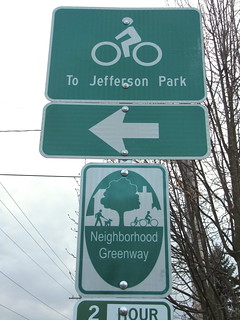
Greenway survey needs your opinions

It’s not just for cyclists, but for anyone who uses the sidewalks and streets of Beacon Hill, whether it be on foot or any type of wheels. Survey results will be shared with the Seattle Department of Transportation and Seattle Police Department to contribute to future policies.
Mayor to announce transportation investments today
Mayor Mike McGinn will visit North Beacon Hill today, Wednesday, September 11, to announce a slate of neighborhood transportation investments that will be part of his upcoming budget proposal.
Among the investments are road maintenance and repair, bridge investments, coordinated transportation planning in four corridors, sidewalks, and more.
The announcement will be at 10:30 a.m. at the Roberto Maestas Festival Street, just north of Beacon Hill Station at Beacon and Lander.
New pavement, detours on S. Graham St. this week
Neighbors around South Graham Street will have new pavement this week, but first, they’ll have to deal with a few traffic complications. The Seattle Department of Transportation plans to grind and pave South Graham Street between Swift Avenue South and 23rd Avenue South this Thursday and Friday, August 29 and 30, weather permitting.
During the work, the street will be closed to eastbound traffic, and drivers will be directed to continue south on Swift to Beacon Avenue South. Work hours will be 8 a.m. to 6 p.m. Pedestrian traffic will not be affected, and police officers will be on hand to keep vehicle traffic moving.
View S. Graham St. repaving, 8/29-30, 2013 in a larger map
Rules of the road not optional
We can all get along if we understand and follow the rules of the road–and maybe add some Beacon Hill courtesy and respect to our commute. As this lovely summer continues, remember that everyone has a right to be safe as we travel through the neighborhood. Next time you see your neighbor struggling to cross Beacon Avenue, remember to stop (not slow, not rush past so she can go behind you) for her. That gaggle of small children crossing McClellan on bikes and scooters? Whether they’re crossing on the Greenway at 18th in a marked crosswalk or 20th at the curb, stop and allow each and every one of them to reach the opposite curb safely.
Special heads-up: if you’re not stopping for pedestrians at the crossing on Forest and Beacon Ave, you might end up with a big ticket. The Seattle Police Department is considering an undercover pedestrian sting operation in that area–that slow stroller-pusher may just be a police officer. (Not that anyone reading this would ever speed past someone pushing a stroller across Beacon Avenue.) SPD may also choose to go with a good old-fashioned marked police car near the library to encourage drivers to slow down (obey the speed limit) and stop for pedestrians. This intersection is a well-known danger zone and SPD is taking community concerns seriously.
Here’s the law of the land:
“In Seattle, the speed limit on residential streets is 25 mph and 30 mph on arterial streets unless otherwise posted. Drivers are expected to know and obey the speed limit.”
That means that McClellan and Beacon have maximum speeds of 30 mph and all side streets have maximum speeds of 25. Notable exception: the Beacon Hill Greenway, which runs from I-90 to Lucile Street and has posted speeds of 20 mph.
“Stopping for pedestrian. The operator of an approaching vehicle shall stop and remain stopped to allow a pedestrian to cross the roadway within a crosswalk unmarked or marked when the pedestrian is upon or within one lane of the half of the roadway upon which the vehicle is traveling or onto which it is turning.” (emphasis author’s.)
Bottom line: slow down and be alert for people trying to cross the street. It’s responsible, it’s respectful, it’s neighborly and it’s the law. If you’re interested in making it safer to walk/bike to school/work/shops in the neighborhood, consider contacting Feet First and/or Beacon BIKES for ideas.
Melissa Jonas has been regularly walking the not-so-mean streets of Beacon Hill since 2003, first with a dog and now with a preschooler. She’s the Chair of the North Beacon Hill Council, which meets next on Sept 10, 7pm in the library community room. All opinions are her own.
Do you have something to say? Send us your own opinion pieces on this or other Beacon Hill-related topics.
Northbound 12th Ave S. closed this weekend in Little Saigon
Heading north on 12th Avenue South this weekend? You’ll need to detour.
First Hill Streetcar project construction will close the northbound lane of 12th Avenue South to through traffic from South King Street to South Jackson Street, starting on Saturday, July 27 at 7 a.m. and continuing until Monday, July 29 at 5 a.m. A detour will be set up here on Beacon Hill, with the diversion starting at 15th Avenue South at South College Street, where traffic will be diverted east, then north on Rainier Avenue South, then west on South Jackson Street to 12th Avenue South.
The intersection of South Jackson Street and 12th Avenue South will remain open to eastbound, westbound, and southbound traffic. Also, 12th Avenue between South King Street and South Jackson Street will remain open to northbound local access traffic, and pedestrian access and access to businesses will be maintained.
Beacon B.I.K.E.S. to meet 6/27
Beacon Hill and Friends –
Summer is fast approaching and Greenway completion is hot on its heels. If you think it ends there, allow us to prove your thoughts incomplete! Because it’s time to celebrate, take a peek into the future of how we move around Beacon Hill and get to the soul of the transportation picture up here. These aren’t pipe dreams; this is what draws us out to meet friends on the street, get to where we want to go, and invites us to go further with active transportation. It’s simply better living.
Join us at the Beacon Hill Library Resource Center from 6-7:45pm on Thursday, June 27th to discuss:
- Greenway updates and improvements
- BeHi walking plan update ideas
- Beacon Rocks! (July 28th concert is transportation-themed)
- (PARK)ing Day
- El Centro Plaza Maestas walk and bikeability audit
As always, we promise light refreshments and good company. We can only make this happen together, Beacon Hill, so we look forward to seeing you on the 27th!
Pedestrian safety project kicks off at Asa Mercer Middle School
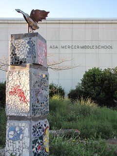
As part of the project, FedEx is presenting the Safe Kids task force with a grant of $25,000 for work throughout the upcoming year to improve permanent walking conditions for child pedestrians in the Asa Mercer community. The task force will create both environmental changes in the area, and educational campaigns to increase pedestrian awareness.