Category Archives: Urban Planning

What do you want to see at the light rail stations?

The train is coming! Photo by Erwyn van der Meer.
We mentioned this before, but it’s worth repeating.

This Saturday, October 25, the Greater Duwamish Council and the SE District Council are co-sponsoring a community meeting to discuss the new neighborhood planning process and “how to create vibrant, successful neighborhoods” at the light rail stations.

The event will be at the New Holly Gathering Hall, 7054 32nd Avenue South, at 12:00 noon, and snacks and child care will be provided.

Concerned about where train riders will park?

The Rainier Valley Post notes that the city wants neighborhood input on parking issues around the soon*-to-be-opening light rail stations in South Seattle.

Regarding Beacon Hill:

The ¼ mile area around the Beacon Hill Station involves both commercial and residential areas. Common parking tools used here may include time-limit signs and a residential parking zone. Community concerns to date include several areas of the neighborhood where parking conditions are already pretty congested at different times of the day. 

When: Wednesday, November 5th at 7 pm
Where: St. Mark’s Lutheran Church, 6020 Beacon Avenue South

You can also submit your comments by email. Full details in the article at RVP.

* soon as in next summer! W00t!

Transit transformation of neighborhood plan?

The City is beginning a process of updating most of the 38 neighborhood plans throughout Seattle, but because of the light rail line opening next summer, Beacon Hill, Mount Baker, and Othello have been fast-tracked for station area planning and neighborhood plan updates. And they do mean fast. The stations open in July, and there is some indication that the city wants rezoning of the area done simultaneously with the plan updates. Things may be changing quickly, folks.

On Saturday, October 25 at 12:00 noon, the Southeast District Council and the Greater Duwamish District Council are hosting a community event to discuss the new neighborhood planning process and “how to create vibrant, successful neighborhoods at these stations.” The event is at the New Holly Gathering Hall, 7054 32nd Avenue South, and food, beverages, and child care will be provided.

Also in the neighborhood planning arena, the city’s Neighborhood Plan Advisory Committee (NPAC) needs four at-large members, “with a good mix of neighborhood knowledge, new passion, and a commitment to healthy communities,” to sit on the committee. The deadline is today, October 17, at 5:00 pm. If you’re interested in helping guide the forthcoming neighborhood planning process as an NPAC member, fill out this PDF and get it in ASAP.

Thanks to the SDC and GDDC for the postcard about the event, and the Rainier Valley Post for getting the news out about the NPAC applications.

“Beacon Hill est omnis divisa in partes tres…”

On the Beacon Hill mailing list today, Mike Cheney asked the question:

“Why has the hill been broken up into 3 sections? You have north beacon, mid beacon and south beacon. Seems like creating divisions in one huge neighborhood could lead to prejudice and a further division of neighbors. Aka my neighborhood is better than yours kind of thing then you end up with even a bigger problem.”

This is an interesting question. Why is Beacon Hill divided into three parts on the city’s neighborhood map, informal as it may be? Unlike Mike, though, I wonder why it’s not divided even more. The Hill is huge. Look at a Seattle map. Beacon Hill is too big to be one neighborhood–it’s really a meta-neighborhood, a large area containing several smaller neighborhoods. North Beacon has its own personality that differs from South Beacon and Mid Beacon. Each area has concerns that the others do not have. For example, North Beacon has sidewalks almost everywhere. South Beacon… not so much. So it makes sense that South Beacon would have sidewalks as a priority, while people in North Beacon would prioritize other things.

A successful, sustainable neighborhood is, ideally, defined by a five-minute or 1/4 mile walking distance from center to edge, and being relatively self-contained and walkable. It would contain about 5,000 residents, and local schools and businesses to serve them. Basically, it’s an area that is small enough that people can easily access local services within the neighborhood, while being large enough to support those services. (It sounds a little small by sprawling modern Seattle standards, but small neighborhood units like this used to be in place here. Look at any old Seattle neighborhood that was built-up before the 1930s, particularly along one of the old streetcar routes, and see how every half mile or so there is a small clump of old commercial buildings, now mostly used as residences. The rise of the car and modern zoning practices have killed a lot of the old neighborhood business districts.) Incidentally, this is approximately the same size as a census tract.

Look at a map: a walk down Beacon Avenue from north to south is more than five miles. To get some perspective–as the crow flies, five miles north of the North Beacon business district “junction” is the University of Washington. Five miles east is Mercer Island. Five miles west is Alki Point. Five miles northwest is Queen Anne. All very different places from Beacon Hill. You can see that Beacon Hill is a pretty huge area! Even dividing it into three zones gives you three “neighborhoods” that are larger than the ideal neighborhood unit.

Each area is going to have its own unique concerns and issues (for example — people in the area near Beacon and Stevens care about what happens to the Stevens Place (Triangle) Park on Beacon, but people who live three miles south on Beacon don’t have any particular interest in that issue), and I don’t believe that recognizing that is a bad thing. I think even smaller neighborhoods on Beacon Hill would be useful, if it meant that we had more of a “community” within our neighborhoods. Folks in South Beacon already feel somewhat marginalized by the focus on North Beacon, and eliminating divisions within the Hill would probably worsen that perception.

Please tell us what you think by commenting here on the blog.
Discuss the bus over pancakes

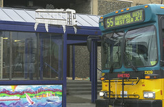
Metro bus in West Seattle -- thanks Seattle Municipal Archives!
We posted earlier about this Saturday’s pancake breakfast, and about potential bus service changes in Southeast Seattle. Today, Jodie Vice of Beacon Hill Pedestrians posted some further information to the mailing list that allows us to combine both topics:

There has been quite a bit of discussion about bus service changes when light rail comes on board. It would be great to have a discussion about this and fill out our surveys as a neighborhood! I’ve contacted Metro and they are sending me about 50 surveys (in multiple languages) to hand out at the Pancake Breakfast THIS Saturday at El Centro – 9:30AM.

A bus service and light rail discussion will go hand-in-hand at our forum on creating a town center, because you can not create a “town center” without adequate access by ALL modes. We have an amazing opportunity with the light rail to be more connected to southend neighborhoods and downtown, but bus service is still crucial for local trips.

The current Metro plans include a potential crosstown route that will connect the Hill with West Seattle, possible changes to the 38 to eliminate redundant service once the light rail opens, and more.

Thanks Jodie and BHP!

Rider’s eye view of Link light rail

I was excited to see this time-lapse video of a trip from Othello Station almost all the way to the Tukwila light rail station:

I can’t wait for the train to open to the public — I just wish we would get more train lines, and faster! But this one will be great for getting from Beacon Hill to the airport, downtown, the stadiums, and just about anywhere in between. Next summer can’t get here quickly enough, as far as I’m concerned.

Via Seattle Transit Blog — thanks!