As many of you know, there is a growing movement among Beacon Hill residents interested in safely getting people of all ages and abilities around and to destinations within our neighborhood on foot and bicycle. This propelled Beacon BIKES!, a growing group of community members, to obtain the knowledge and expertise of a consultant to bring our collective vision to fruition. (Links available describing some of our ideas can be found on the September 3rd posting on this blog.)
Friday, we chose Alta Planning + Design as our consultant from among three enthusiastic applicants. Beacon BIKES! believes that pedestrians and cyclists encounter similar obstacles in getting around our neighborhood and that facilities that address both modes make the most sense. This philosophy is in line with Alta’s belief in “integrating all modes of travel (including walking and bicycling) into the daily lives of residents and creating healthy, safe, and sustainable communities.â€Â Most importantly, they offer an interactive approach geared to keeping the neighborhood informed and involved throughout the process.
All this is great news, but in order for this to work, we’ll need anyone and everyone to chime in at our monthly Beacon BIKES! meetings to make this a uniquely Beacon Hill plan. The next meeting will be held at the community room of the Library at 6:30 PM on Monday, September 13th. SDOT representatives will be in attendance, so the more Beaconites there, the more seriously our work will be taken. If you’re not involved already, you will want to be after this meeting!
In addition, there will be opportunities to participate through community forums, walks and other interactive outings to make this circulation plan for us and by us.
As always, you can prepare for the next Beacon BIKES! Family Bike and Pedestrian Circulation Plan meeting by visiting our Facebook page: Beacon BIKES!
You may also contact Sandra Woods or Brian Dougherty of SDOT and our City Council members to let them know you are a participant in and support our Family Bike and Pedestrian Circulation Plan.
Be sure to check back to the blog for updates. We hope to see many of you at the meeting.
Thanks Beacon Hill!
Category Archives: Getting Around
Open house Tuesday on proposed road changes in Mid-Beacon
15th Avenue South between South Bradford Street and South Oregon Street (the red line on the map below) currently consists of four travel lanes with parking restricted at the morning and evening peak rush hour. Motor vehicles often travel significantly faster through this corridor than the speed limit of 30 mph. SDOT is proposing to remove on-street parking from both sides of the street, remove one northbound travel lane, widen the travel lanes and install dedicated bike lanes in both directions.
15th Avenue South between South Oregon Street and Swift Avenue South (the green line on the map) currently consists of one travel lane in each direction with parking on both sides of the street. There are marked school crosswalks at South Dawson Street and South Shelton Street for Maple Elementary School and St. George School as well as a school speed zone for Cleveland High School. SDOT is proposing a combination of a bicycle lanes where the road is uphill and sharrows where the road is flat or downhill. On-street parking would be removed from the east side of the street between South Lucile Street and South Dawson Street, and from the west side between South Dawson Street and South Angeline Street. Removing street parking in this alternating fashion will provide some traffic calming at the school crosswalks.
South Columbian Way between Beacon Avenue South and South Alaska Street (the blue line on the map) currently consists of four travel lanes. SDOT is proposing to remove one downhill lane and install dedicated bicycle lanes in both directions.
These proposals, when completed, will create continuous bike facilities from downtown Seattle and North Beacon to Mercer Middle School, Cleveland High School, Mid-Beacon Hill and Columbia City. If approved, these changes would be implemented in 2010. This project is funded by the “Bridging the Gap” transportation levy approved by Seattle voters in 2006.
You are invited to stop by the Open House and view project plans, provide feedback and chat with the project team. The event is Tuesday, August 24 from 5:00 – 7:00 pm at the Jefferson Community Center Meeting Room, 3801 Beacon Avenue South. You may also email your comments to walkandbike@seattle.gov or call 206-684-7583.
(Much of this article is adapted from SDOT’s press release describing the project. Thanks to Peg Nielsen for sending it along.)
View “Complete Streets” changes in Mid-Beacon Hill in a larger map
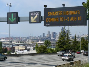
I-5 getting smarter next week
The Smarter Highways website has an animation to show how the system will work. Here’s a longer video about the system. According to the video, systems such as this have been used in Europe with success, reducing traffic-related collisions by 30%.
Construction, Seafair to cause traffic delays
You might particularly want to note a few special events. The Seafair Torchlight Run will cause the northbound lanes of the Alaskan Way Viaduct to be closed tonight from 5:45pm to 7:45pm, and the Torchlight Parade will close Fourth Avenue all the way from Broad Street near Seattle Center, south to Qwest Field. Next week, the Blue Angels will return to buzz Beacon Hill on August 5-8, in the process closing I-90 to traffic from 9:45am to noon and 1:15 to 2:30pm on August 5, and from 12:45 to 2:40pm on August 6-8.
Sound Transit still working to fill voids
Starting Monday, July 19, Sound Transit will return to Beacon Hill to continue underground exploration and backfilling work near Beacon Hill Station related to the voids discovered last year. Expect restricted parking, flaggers directing traffic, heavy equipment, and some noise. Construction is anticipated to take at least two months.
Among other impacts, the remediation work will reduce 17th Avenue South from South McClellan to South Waite to one travel lane, and drivers will be assisted by flaggers to safely get around the drilling equipment. Further information on the project activities can be found on this PDF.
These activities will be the first phase in the current work plan of exploratory operations to find and fill the remaining voids. The subsequent phases of the work plan focus solely on private property. If you have not been previously contacted by Sound Transit, no work will be on your property.
If you have any questions about the project or the Beacon Hill Station in general, please contact Jennifer Lemus, Sound Transit Community Outreach, at 206-398-5314.
This map shows the section of 17th Avenue South that will be affected by the lane closure, sidewalk closure, and parking restrictions:
View Sound Transit Void Remediation Work, Summer 2010 in a larger map
Lane closed today on Rizal Bridge; rehab work done
The Seattle Department of Transportation (SDOT) will close one southbound lane on the Dr. Jose Rizal Bridge at the north end of Beacon Hill today from 9:00 am to 3:00 pm. The closure is required to allow engineers to perform a routine inspection of the bridge. This closure may be rescheduled, however, if crews are called on do emergency work elsewhere.
SDOT has substantially completed the rehab project on the bridge. The project was necessary to extend the life of the bridge, built in 1911, and reduce the frequency of major maintenance and repair. The bridge is the state’s oldest steel arch bridge, and is on the National Register of Historic Places. The rehabilitation project included repairing concrete spallings on the bridge deck, installing a new sidewalk concrete overlay, repairing and sealing cracks in the concrete, and repairing or replacing deteriorating expansion joints and a concrete girder.
Changes coming to 15th Ave S this month
Later this month, the Seattle Department of Transportation (SDOT) will begin work on the repaving and rechannelization of 15th Avenue South between South College Street and South Spokane Street. (We posted about this project when it was getting started last year.)
The project to improve 15th will include include traffic lane reconfiguration along with pedestrian and bicycle improvements, including:
- Resurfacing the asphalt pavement on 15th between Beacon Avenue South and South McClellan Street.
- Installing new curb bulbs and ramps at 15th and South Lander Street.
- Adding sidewalk improvements at Beacon and McClellan.
- Adding two new marked crosswalks at 15th and Lander.
- Installing pedestrian warning signs at 15th and McClellan.
- Retrofitting existing ADA ramps with tactile (detectable) warning pads.
- Adding new bike facilities between College and Spokane.
SDOT will be removing parking from one side of the street in each block, using alternate-side-of-the-street parking as a traffic calming technique. Additionally, there will be a much-needed right-turn-only lane at the intersection of 15th Avenue South and South Spokane Street, when going southbound. You can read more about the rechannelization here.
Work on the project is scheduled to begin in mid-July and continue through September. You should expect lane closures, pedestrian detours, parking and loading restrictions, and the usual construction noise and mess. More information about specifics will be coming soon.
View 15th Ave S rechannelization project in a larger map
UPDATED: 17th and Forest street repair planned for Saturday
This Saturday, Seattle Department of Transportation (SDOT) paving crews will be working at 17th Avenue South and South Forest Street, near the Beacon Hill Library. Traffic in both directions on 17th will take turns sharing one lane with the assistance of traffic flaggers. Anticipated work hours for the project are 9:00 am to 6:00 pm.
Update, 6/25: SDOT tells us the reason for the paving work is to prepare for pedestrian activated crosswalk lights that will be installed in the crosswalk later this summer. The lights will flash when a pedestrian activates the lights prior to crossing the street. Funding for the project comes from the Neighborhood Project Fund and the Bridging the Gap transportation initiative approved by Seattle voters.
View 17th and Forest Street repair in a larger map
Opinion: Alley speeders need to slow down
(Do you have something to say? Send an emailed letter or opinion piece to the BHB editors. You must sign your full name and address for your letter/opinion piece to be published.)
by Jennifer Zwick
I live on 14th and South Hinds Street, an area right by the freeway exit. People often drive very fast on this almost one-lane neighborhood street, in order to cut down to the freeway (thus bypassing 15th and therefore saving seconds of time). Since we don’t have sidewalks, and the road has two curves, it is very dangerous—poor visibility, and literally nowhere for pedestrians to go.
When even this shortcut takes too long, they also often bypass even 14th/South Hinds Street, and instead cut at high speeds through my alley. This is even worse, since it’s very narrow and abuts right next to all property—and of course, no alley sidewalks as well.
A few days ago, I was walking in the alley to my house (I take the alley due to lack of street sidewalks) when a man, smoking and driving a silver Lexus SUV, sped towards me up the alley from the freeway. Please keep in mind that I am very obviously pregnant, which makes me slower than normal. Regardless, apparently this short pregnant pedestrian didn’t move out of “his” way fast enough, so, barely stopping, he rolled his window down and shouted “this road is for cars.” No sir, it is not. It is an alley. It is for property access. There are actual roads to the left and right of this alley. This kind of thing is, unfortunately, common.
I feel this is very unsafe but don’t know what to do. My dream would involve a speedbump or two in the alley to prevent speeding impolite people shaving off fractions of a second of their drive by taking the alley instead of a road, and sidewalks on the curved stretch of South Hinds Street.
(Anyone have any advice for Jennifer? We suggested that she check out the SDOT Neighborhood Traffic Operations: Traffic Calming Program website, but we hope some of you have better advice.)
Opinion: Pedestrian crossing at Beacon and Lander demands attention
Since the light rail station opened last summer, the crosswalk at Beacon and Lander has become the busiest on Beacon Hill. The majority of the people exiting the station are headed west to go to the bank, Red Apple, the southbound bus stop, or home. All of these people must cross Beacon, and many get very creative in the process. Because the crossing is way out at the corner and runs diagonally to the corner away from Red Apple and the bus stop, many people choose to just cross through the middle of the street. Because the crosswalk—which now has flashing beacons and signage, but once only had markings on the pavement—is at the intersection with Lander, there is not only north-south traffic moving through but also people turning onto Beacon from Lander. With the long crossing, the multitude of car approaches, and the scurrying light rail riders, it is ripe for an accident.
The other day I camped out at the crosswalk from 5:00-6:00 pm and filmed about 16 pedestrian crossings when cars were around. I put them together and, with very little editing, made this video:
This was not a “best of” video, but simply what you see at every rush hour here. After bemoaning the miserable state of our most popular Beacon crossing, I started to think about how the pedestrian infrastructure at all the other light rail stations in Seattle seemed satisfactory and even exemplary. Yesterday I decided to take a ride on the light rail and check out each station and then do a little compare and contrast with what we have been dealt. The results from this foray are here:
Apparently Sound Transit is only responsible for putting things back the way they found them, and Seattle’s Complete Streets Ordinance—which requires attention to pedestrian safety among other things—does not apply to them when they do their repave this summer. The Seattle Department of Transportation (SDOT) has been working with Beacon BIKES! to improve this crossing, but they have limited funds. I am suggesting that Sound Transit work with us and SDOT to improve this crossing as part of the repave this summer. If you want to get involved please email me at dsahearn@gmail.com, and attend the next Beacon BIKES! meeting on Monday, June 21, at 6:00 pm at the Beacon Hill Library, 2821 Beacon Avenue South.
Be Safe!
(This is Dylan’s first post for the Beacon Hill Blog. Thanks, Dylan! — Editor.)