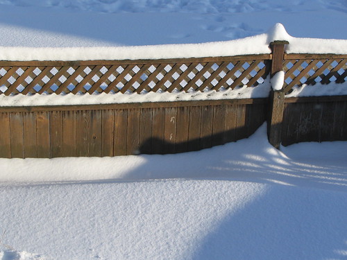
Snow in a Beacon Hill yard during the big December snow of 2008. Photo by Wendi.
Cliff Mass says, “The new forecast models are increasingly threatening for colder temperatures and lowland snow from Sunday through Wednesday of next week,” though he does qualify this prediction, stating that the forecasts aren’t “ideal for a truly major event.” Define “truly,” Cliff.
Anyway, we all live on a hill, like many Seattle residents, and know that snow can provide some unique challenges to mobility. Unlike many neighborhoods, however, we have access to Link light rail, which should make it easy to get around—as long as you are going where the train does.
If it really does snow, and South McClellan is closed to cars, I recommend using Link as a ski lift. Ski down McClellan to Mount Baker Station. Take the train back up to Beacon Hill Station. Get a hot cocoa at The Station. Ski down again. Repeat. Your ticket is good for two hours. (If you actually try this, I’d love to see photos and video.)
Be prepared, stay warm, and cross your fingers for next week, whether you’re a snow-lover or a snow-hater.
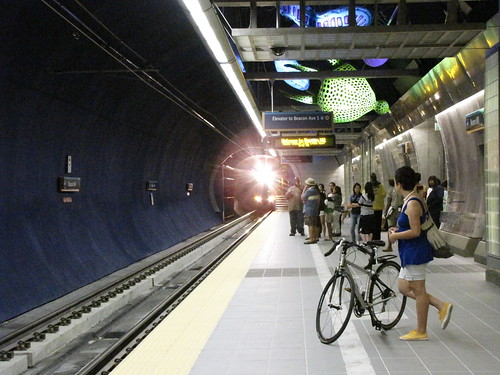
Waiting for the train in Beacon Hill Station. Photo by Wendi.If you are planning to take Link light rail to your New Year’s Eve celebrations, you’re in luck. Link will have slightly extended hours on Saturday night, December 31, to make it easier for you to ride home in the wee hours of 2012.
There will be two additional southbound trips from Westlake Station, at 12:58 a.m. and 1:13 a.m. The last northbound trip isn’t so late—it leaves Sea-Tac Station at 12:20 a.m.
On Sunday, New Year’s Day, and also on Monday, January 2, Link will run on a Sunday schedule, which means that the first northbound train won’t reach Beacon Hill Station until 6:43 a.m., and trains will run only every 10 minutes during most of the day. Service will return to normal on Tuesday, January 3.
Today’s loser: Residents of Southeast Seattle who might, had Sound Transit not decided to build an expensive (and over-budget) station through Beacon Hill, have had two more light-rail stations in their part of the city.
Barnett’s analysis appears to be in error, however. She claims that:
…The distance between stations on the south end of the line is much longer than in the central, north, and (planned) east portions of the line: Nearly two-and-a-half miles from station to station, compared to just over 1.5 miles for the north section and just over a mile for the central portion.
However, the 2009 Seattle Transit Blog article in which she has found this statistic is not referring to Southeast Seattle when it describes “South Link.” The existing light rail line, from Westlake south to Sea-Tac, is known as “Central Link,” and is listed on the STB article with an average station distance of about 1.2 miles. “South Link,” on the other hand, is used in the STB post to refer to the extension of the line from Sea-Tac to Tacoma (or Redondo/Star Lake — it’s unclear which version of the proposed line is being referred to here). The distance between the Rainier Valley stations actually averages (very roughly) 1.25 miles.
Also mentioned in the Publicola article is a statistic from the February 2010 Metro/Sound Transit rider survey (also discussed on Seattle Transit Blog), showing low ridership numbers at Beacon Hill station, with only two percent of riders boarding at Beacon Hill. To put the number in context, this total was just above SODO and Stadium stations (one percent or fewer), and just below Mount Baker, Othello, and Columbia City (each of which accounted for three percent of daily boardings). SeaTac/Airport (30%) and Westlake (23%), unsurprisingly, accounted for the highest number of boardings.
More recent numbers released by Sound Transit last month (February – June station activity based on actual boarding data instead of survey responses as was the February survey) found here and here show Beacon Hill Station with more boardings than Columbia City, Othello, Rainier Beach, SODO and Stadium, and more deboardings than all of the above plus Mount Baker, and only a few short of Pioneer Square.
Alleycat Acres and ROCKiT space are planning to transform this yard into an educational garden for the community. Photo courtesy of ROCKiT space.Alleycat Acres and ROCKiT space have been pretty busy in the neighborhood lately. Now, they are working together to build an educational community garden in the backyard at ROCKiT space. On Saturday from 1:00-5:00 pm, the two groups are inviting the community to a work party to transform the space. They will also sell plant starts and baked goods to help raise funds for the garden, and there will be music and artsy activities as well as a potluck. To help out, email rockitspace@gmail.com or volunteer@alleycatacres.com or just show up on June 12th. ROCKiT space is located at 3315 Beacon Avenue South. For more information, see the website.
* * *
El Centro de la Raza is hosting another series of Spanish classes, to begin on June 28. Classes are instructed by professional native Spanish speakers in an interactive community-based setting. Classes will be on Mondays and Wednesdays from 6:00 pm to 7:30pm. Go here for information and a registration form. If you have questions, please call (206) 957-4605 or email execasst@elcentrodelaraza.org.
* * *
The last two parts of Kevin Minh Allen’s three part series in the International Examiner, “Beacon Hill, Our Story,” are online now. Read the full series here: part I, part II, part III.
Speaking of Link, Mike Lindblom reported in Sunday’s Seattle Times (BHB news partners) that there are still issues with the noise of the trains in Tukwila, along Martin Luther King Jr. Way South, and along the curve near Mount Baker Station and the Beacon Hill tunnel, though a lubrication system added last winter has helped somewhat. Have you noticed the noise, and have you noticed any improvement?
* * *
Dan Bennett took this cool panoramic photo of Jefferson Park recently. Click on it to see a larger version. Once you’re there, click “Original” to see a much larger version.
* * *
A land use application has been filed to allow change of use in the basement of an existing apartment structure at 1731 South Horton Street to a religious institution (Zen Buddhist Meditation Center); it would require approval of an Administrative Conditional Use to allow an institution in a single family zone. See this bulletin for further information. The comment deadline is June 20.
* * *
Lastly, we wanted to pass on some information about a financial assistance program that is currently open for low-income families in Seattle. Central Area Motivation Program (CAMP) offers an Energy Assistance Program that provides financial assistance through LIHEAP and Puget Sound Energy HELP to help low-income families and individuals pay home heating bills and minimize future home heating costs. Eligible clients can receive up to $1,000 through LIHEAP or Puget Sound Energy for utility payment assistance and up to $5,000 for dysfunctional heating system, chimney, or window repair or replacement. For more information, see the website or call the Appointment Hotline at 1-800-348-7144.
Once, many years ago, I was in a very bad financial situation and CAMP’s program was what kept the heat from being turned off in my apartment that winter. I want to take this opportunity to thank them for being there when I needed help. If you know anyone who might need similar help, please do make sure they get information about CAMP’s program.
The tunnel “voids” affecting properties above the Link Light Rail tunnel path through the hill continue to be identified and addressed. From an article in the Engineering News-Record:
Crews have filled in about 80% of nine voids leftover from a 2-mile tunneling job through Seattle’s Beacon Hill. Japan’s Obayashi Corp. did not discover the voids while boring the parallel, 1-mile tunnels as part of its $280-million contract, which has since increased to $312 million. Owner Sound Transit contends the contractor is at fault.
. . .
“We put Obayashi on notice that we think this is an avoidable situation, and the cost is going to be withheld from its final payment,†Gray says. Sound Transit has spent $1.6 million filling the voids.
“The adequacy of the geotechnical data supplied by Sound Transit and the actual behavior of the ground during construction are under discussion with Sound Transit,†says Obayashi spokeswoman Carmen Stone.
And they’re not quite done yet: Sound Transit estimates about 430 cubic yards remain left to find and fill. Read the rest of the article at ENR.
The removal of construction scaffolding from some offramp overpass projects in Sodo will prevent Link Light Rail from running north of Sodo station at Lander Street this weekend. From our news partner, the Seattle Times:
Link light-rail service will not run through the downtown Seattle Transit Tunnel and parts of the Sodo area this weekend as state Department of Transportation contractors remove scaffolding supporting a new offramp over the tracks and station just south of downtown.
Free bus shuttles will carry Link passengers from the Sodo light-rail station at South Lander Street via Sixth Avenue South to the tunnel stations. King County Metro and Sound Transit bus routes that normally use the Sodo busway will also be detoured during the work.
V - Vehicle break-ins, B - Burglaries, R - Robberies, S - Shots firedRosie Kirby writes, hoping someone might have seen something of interest today near her home that was burgled today:
We live on the corner of 13th and Hill St. in North Beacon Hill. Our house was broken into with what looks like possibly some sort of crowbar or having kicked in the door somewhere between 7:10 a.m. and 4 p.m. today, 2/22/10. Our neighbor (these are town homes) reports that she heard the door open and shutting around 1:00 p.m. but did not think to look and see if anything was going on. Luckily, not too much was stolen; however, we would appreciate any information or if anyone saw any suspicious activity. The burglar may have left with the laptops, money, and miscellaneous in a brown QFC paper bag. We had one hanging in the kitchen for recycling and they dumped the contents onto the couch.
If you may have any information that could help track down the thieves or recovery their stolen property, please call Rosie at 701-610-4555 or Seth at 206-914-0557 or email rak711@hotmail.com.
April Jahns reported a Saturday-night smash-and-grab on the mailing list and followed up with video:
Some punk smashed the passenger side window of our minivan last night. We got it on video – it’s pretty grainy, though. When Ryan is done converting and snipping and whatever else he has to do to the footage I’ll post it on youtube and send a link to the listserv. The person had to rifle around for a minute before finding a grocery bag (hid well out of sight) to find my stash of Valentine’s Day candy conversation hearts. Maybe he’ll get a cavity as his punishment.
We did call the police and since we have the video an officer came out and he dusted the van for prints and will pick up a copy of the video tomorrow. He couldn’t stress enough how important it is for us to call when we see someone suspicious walking around – it enables the officers to talk to fishy looking people. He said the report allows them to pull suspicious looking people over to talk to them. Of course, this happened at 5:10 am – if I had seen him walking by my house I would have seen him breaking into my car. A
car around the corner from us was broken into as well. The officer said there have been lots of prowls in this area (I’m at 16th & Bayview) and they have been patrolling but the commission of the crime is so fast that its hard to catch them in the act.
* * *
Mike Rosen wrote about another smash-and-grab Sunday night on the BAN list:
We live on the 1300 block of 13th Avenue South, close to Atlantic. Around 2 am the car alarm on our Honda went off. (I am sure some of you heard it.) One of us went down to check. No signs of break in. This morning I left for work and noticed the Eclipse that was parked behind the Honda had had its driver’s window shattered. I called 911 to report it, and they said that the owner must call it in. I left a note for the car’s owner. My older Subaru had not been broken into.
On February 22nd at approximately 7:11 p.m. officers on patrol heard shots fired near the light rail tracks at MLK Way South and South Winthrop Street. Officers searched further and discovered an adult male victim (possibly in his 30’s) who had sustained a through and through gunshot wound to the arm. The victim was transported to Harborview Medical Center for treatment.
Officers are currently interviewing additional persons who were in the area at the time of the shooting. A possible suspect vehicle was seen fleeing the area. That vehicle is described as a green Chevy Impala with shiny chrome rims. There is no suspect description available at this time. Officers continue to actively investigate this incident. Gang Unit detectives have been notified and will be conducting the follow up investigation.
One of several signs posted on the elevators, ORCA scanners, and ticket vending machines at the station entrance.
12:08 pm update: According to an announcement on Sound Transit’s website, the station has reopened. However, you should be aware that the ticket machines at the station are currently not accepting credit and debit cards — cash only. (This problem predates the station closure.)
* * *
The Link light rail station at 2700 Beacon Ave S is closed. bhnw.org scanner logs indicate it is closed until Monday. Metro is running shuttle buses from in front of the station to Mount Baker Station on the east side of the hill. Sound Transit and Metro customer information lines make no mention of this closure as of 10am, but there is a posting on the Sound Transit website.
KIRO noted the closure at about 1am on Twitter: “ST: Beacon Hill Station is out of service, closed. They are experiencing some sort of signal issues. Back up bus service is available.”
Security personnel at the station do not have any information regarding the reason for the closure or when it will re-open.
10:10 update: After multiple attempts and a lengthy wait on hold, a Metro customer service agent says the only information they have is that “The tunnel between stations closed, shuttles until further notice on Saturday.”
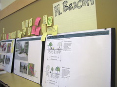
Neighbors posted comments on zoning and street configurations at the Neighborhood Plan update open house last September. Photo by Wendi.On Tuesday, February 10, the Hearing Examiner’s Office conducted a prehearing conference regarding the appeal filed by Frederica Merrell to vacate the Determination of Non-Significance (DNS) for the North Beacon Hill Neighborhood Plan update. There was also a prehearing conference for the appeal against the Othello update. The North Rainier (a.k.a. Mount Baker) appeal will be heard by the Hearing Examiner on February 16.
These meetings are the first of many steps to examine the merits of the identical appeals filed by separate individuals against the Neighborhood Plan updates. These meetings are costing City of Seattle taxpayers money and taking staff time away from other DPD business. They are also delaying any progress on the work plans associated with the Neighborhood Plan Updates and halting any development and/or design plans for the sites involved.
El Centro de La Raza has lost $75,000 in funds offered to help them begin preliminary community outreach to discuss design and development ideas for their property. They cannot begin to move forward on developing their site until there is some indication that zoning issues will be resolved. El Centro is a valuable community partner. They would like to develop their property in the best interests of the neighborhood. They cannot begin the conversation about how to do that until the zoning issues are resolved.
Let’s be very clear: the Neighborhood Plan Updates are totally, completely about zoning. The entire point of the Neighborhood Plan Updates—the only reason they were ever developed—was to discuss zoning in the specific areas around the light rail stations. They were not intended to be and will never be replacements for the extensive Neighborhood Plans our communities have in place.
All other issues are red herrings. Concurrency is a completely unrelated issue to the upzone conversation—apples and oranges. The Neighborhood Plan validation process is also completely unrelated—a completely separate process.
This is the core of El Centro’s counter-appeal. DPD can clearly demonstrate that these appeals are too general and many of the complaints are outside the jurisdiction of the Hearing Examiner’s office and outside the scope of the update.
From El Centro’s Motion to Dismiss:
“El Centro de la Raza makes a motion to dismiss this appeal because Ms. Merrell appears to be raising issues related to the passage of the North Beacon Hill Plan, rather than the adequacy of the City’s environmental review. The North Beacon Hill Plan has not been adopted by the City Council yet. No changes to the Comprehensive Plan, nor to the zoning code, have yet occurred. Therefore, any issues related to the North Beacon Hill Plan itself, or related to any potential future zoning change, are not ripe for the Hearing Examiner’s review. In addition, any issues related to the Growth Management Act are not properly before the Hearing Examiner and must be dismissed.
In the alternative, El Centro suggests to the Hearing Examiner that the appeal is essentially limited to a single legal issue: whether the City properly exercised its discretion under WAC 197-11-055, 197-11-060, and 197-11-228 to complete proper environmental review of comprehensive planning documents. We ask that the Hearing Examiner dismiss all other issues raised by Ms. Merrell, as such claims are related to the unadopted plan or possible future zone changes. ”
Unfortunately, it’s going to take weeks (if not months) of public employee time away from actual projects to address these appeals. These appeals are an expensive time-wasting strategy with an end goal of keeping things in limbo.
Development will happen, but it’s going to take years and millions of dollars longer because a very simple zoning question—one that has received a significant amount of community feedback—is not being answered. That’s a shame.
(Melissa is a columnist for the Beacon Hill Blog and recently wrote about speeding drivers on the Hill in her column “Walking with Tica.â€)
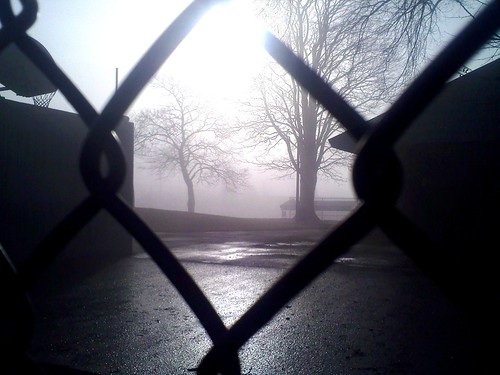
During the last year, many of you have contributed amazing photos to the Beacon Hill Blog photo pool on Flickr. The photos you see here today were chosen from the nearly 700 photos that were taken and posted in the photo pool during 2009. Some were chosen because of their photographic beauty; others, because they captured newsworthy moments on the Hill. Some of these we’ve published before, and some we haven’t.
We would like to thank all of our wonderful Beacon Hill photographers for posting photos to the pool and their generosity in allowing us to share them with you. We hope you enjoy this look back at 2009. Happy New Year! A foggy morning at Beacon Hill Playfield in January. Photo by Bridget Christian.Enjoying the horsie ride at the Red Apple. Photo by melissajonas.Keeping cool in a Beacon Hill condo pool, late July. Photo by Bridget Christian.A door opened in the July heat at Kusina Filipina. Photo by l0st2.Waiting to try the new light rail train on opening weekend at Beacon Hill Station. Photo by Jason.Continue reading A photographic look back at 2009 on Beacon Hill→